Near Elizabethton in Carter County, Tennessee — The American South (East South Central)
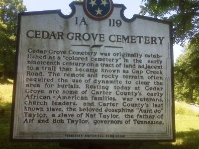
Cedar Grove Cemetery
Erected by Tennessee Historical Commission. (Marker Number 1A 119.)
Topics and series. This historical marker is listed in these topic lists: African Americans • Cemeteries & Burial Sites. In addition, it is included in the Tennessee Historical Commission series list.
Location. 36° 19.517′ N, 82° 14.733′ W. Marker is near Elizabethton, Tennessee, in Carter County. Marker is on Southside Road, on the right when traveling east. Touch for map. Marker is in this post office area: Elizabethton TN 37643, United States of America. Touch for directions.
Other nearby markers. At least 8 other markers are within 2 miles of this marker, measured as the crow flies. Fort Watauga Monument (approx. 1.1 miles away); Monument to the Patriots (approx. 1.1 miles away); Sycamore Shoals of the Watauga (approx. 1.3 miles away); a different marker also named Sycamore Shoals of the Watauga (approx. 1.3 miles away); Watauga Purchase (approx. 1.3 miles away); Transylvania Purchase (approx. 1.3 miles away); Watauga Fort (approx. 1.3 miles away); Uncovering the Past (approx. 1.3 miles away). Touch for a list and map of all markers in Elizabethton.
Credits. This page was last revised on June 16, 2016. It was originally submitted on August 1, 2009, by Melanie Storie of Elizabethton, Tennessee. This page has been viewed 1,955 times since then and 20 times this year. Last updated on March 12, 2015, by J. Makali Bruton of Accra, Ghana. Photo 1. submitted on August 1, 2009, by Melanie Storie of Elizabethton, Tennessee. • Kevin W. was the editor who published this page.
