West Carrollton in Dallas County, Texas — The American South (West South Central)
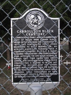
Carrollton Black Cemetery
Inscription.
Carrollton’s early African-Americans, many of whom were former slaves, helped settle and build the community. By 1871, this portion of forty acres belonging to Scott Boswell, Sr., an African-American farmer, was a community cemetery. In 1915, C.B. Baxley acquired the cemetery and surrounding land. Although the site holds dozens of burials, only three names (Ned Welch, Loving, and Davis) are now visible. Joyce Collins (1960) is believed to be the last burial. No records exist for others buried here; flooding from the Elm Fork of the Trinity River destroyed many grave markers. Once threatened by new development, the site is a precious record of the early history of Carrollton.
Marker is property of the State of Texas
Erected 2010 by Texas Historical Commission. (Marker Number 17371.)
Topics. This historical marker is listed in these topic lists: African Americans • Cemeteries & Burial Sites. A significant historical year for this entry is 1871.
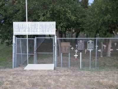
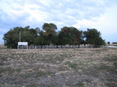
Location. 32° 57.02′ N, 96° 55.202′ W. Marker is in Carrollton, Texas, in Dallas County. It is in West Carrollton. Marker can be reached from West Belt Line Road, 0.2 miles west of Hutton Drive, on the left when traveling west. Cemetery and marker are in a field just south of W Belt Line Road, between Luna Road and Hutton Drive. Touch for map. Marker is at or near this postal address: 1525 West Belt Line Road, Carrollton TX 75006, United States of America. Touch for directions.
Other nearby markers. At least 8 other markers are within 3 miles of this marker, measured as the crow flies. A different marker also named Carrollton Black Cemetery (within shouting distance of this marker); Blanton Grain Tower (approx. ¾ mile away); Pioneer Park (approx. 0.8 miles away); St. John Baptist Church (approx. 0.9 miles away); Alex W. and Sarah Perry Homestead (approx. 1½ miles away); The Perry Cemetery (approx. 1.6 miles away); Union Baptist Church (approx. 1.6 miles away); Dallas County's First Methodist Society (approx. 2.4 miles away). Touch for a list and map of all markers in Carrollton.
Credits. This page was last revised on February 2, 2023. It was originally submitted on March 17, 2015, by QuesterMark of Fort Worth, Texas. This page has been viewed 1,204 times since then and 162 times this year. Last updated on February 26, 2020, by J Frye of Fort Worth, Texas. Photos: 1, 2, 3. submitted on March 17, 2015, by QuesterMark of Fort Worth, Texas. • J. Makali Bruton was the editor who published this page.


