San Juan Bautista in San Benito County, California — The American West (Pacific Coastal)
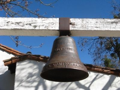
El Camino Real Bell
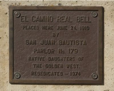
upper marker:
Placed here June 24, 1910 by San Juan Bautista Parlor No. 179 Native Daughters of the Golden West. Rededicated 1974.
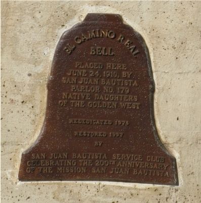
lower marker:
El Camino Real Bell, placed here June 24, 1910, by San Juan Bautista Parlor No. 179 Native Daughters of the Golden West. Rededicated 1974. Restored 1997 by San Juan Bautista Service Club celebrating the 200th anniversary of the Mission San Juan Bautista.
Erected 1979 by San Juan Bautista Chapter No.179 - Native Daughters of the Golden West and San Juan Bautista Service Club.
Topics and series. This historical marker is listed in these topic lists: Exploration • Roads & Vehicles. In addition, it is included in the El Camino Real, “The King's Highway” (California), and the Native Sons/Daughters of the Golden West series lists. A significant historical month for this entry is June 1996.
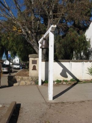
Location. Marker has been reported missing. It was located near 36° 50.712′ N, 121° 32.169′ W. Marker was in San Juan Bautista, California, in San Benito County. Marker was at the intersection of Second Street and Mariposa Street, on the right when traveling south on Second Street. Marker and Bell are located at the entrance to Mission San Juan Bautista and the San Juan Bautista State Historic Park. Touch for map. Marker was at or near this postal address: 300 Second Street, San Juan Bautista CA 95045, United States of America. Touch for directions.
Other nearby markers. At least 8 other markers are within walking distance of this location. San Juan Bautista Plaza Historic District (within shouting distance of this marker); Progress Becomes History (within shouting distance of this marker); The Amah Mutsun Garden (within shouting distance of this marker); Castro/Breen Adobe and Plaza Hotel (within shouting distance of this marker); Castro - Breen Adobe (within shouting distance of this marker); Mission San Juan Bautista (within shouting distance of this marker); El Camino Real (about 300 feet away, measured in a direct line); Veterans of the World War (about 300 feet away). Touch for a list and map of all markers in San Juan Bautista.
Also see . . .
1. The El Camino Real Bells. California Bell Company website entry:
The first bells were designed and produced by a woman, Mrs. A.S.C. Forbes, known as America's First Woman Bell Maker. Her first El Camino Real Bell was erected in front of the Plaza Church in Los Angeles in 1906. The bells continued to be largely produced in the 1920's. Originally there were about 370 bells along El Camino Real, but because of theft and vandalism the number has dwindled to about 75. (Submitted on January 15, 2009, by Syd Whittle of Mesa, Arizona.)
2. The El Camino Real - "The Kings Highway". California Highways website entry:
Article details the location of the 21 California Missions. (Submitted on January 15, 2009, by Syd Whittle of Mesa, Arizona.)
Credits. This page was last revised on September 29, 2022. It was originally submitted on January 15, 2009, by Syd Whittle of Mesa, Arizona. This page has been viewed 2,279 times since then and 30 times this year. Last updated on April 7, 2015, by James King of San Miguel, California. Photos: 1, 2, 3, 4, 5, 6. submitted on January 15, 2009, by Syd Whittle of Mesa, Arizona. 7. submitted on April 7, 2015, by James King of San Miguel, California. • Bill Pfingsten was the editor who published this page.
