Niagara Falls in Niagara County, New York — The American Northeast (Mid-Atlantic)
Great Gorge Railway Trail
Niagara Gorge Trail System
— Suspension Bridge Interpretive Area —
Inscription.
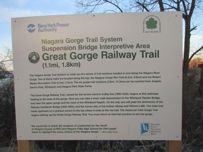
Gorge Trail 4·Great Gorge Railway.(1.1mi, 1.8km)
The Niagara Gorge Trail System is made up of a series of trail sections located in and along the Niagara River Gorge. Two of these trails are located along the top: the Niagara Gorge Rim Trail (6.2mi, 9.9km) and the Robert Moses Recreation Trail (3.2mi, 5.1km). The six gorge trail sections (7.6mi, 12.2km) can be reached from Artpark, Devil's Hole, Whirlpool, and Niagara Falls State Parks.
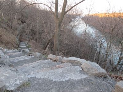
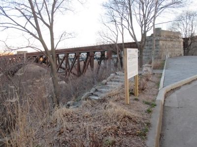
Gorge Railway Trail, named for the former electric trolley line (1895-1935), begins at this staircase leading to the base of the gorge. Here you can take a short walk downstream to the Whirlpool Rapids Bridge, and view the upper gorge and the head of the Whirlpool Rapids. On the way you will pass the abutments of the Railway Cantilever Bridge (1883-1925), and the former site of the incline railway and Witmer's Mill. The main trail leads upstream on a gradual ascent to the top where it ends at the rim trail. The American Falls Gorge Trail begins halfway up the Great Gorge Railway Trail. You must return to that trail junction to exit the gorge.
"We would like to thank the students of Leadership for the Youth of Niagara County (LYNC) and Niagara Falls High School for their good ideas to highlight the may virtues of the Niagara Gorge." —NYPA/State Parks. Niagara Falls National Heritage Area.
Erected by New York Power Authority, New York State Office of Parks Recreation and Historic Preservation.
Topics. This historical marker is listed in these topic lists: Bridges & Viaducts • Railroads & Streetcars • Waterways & Vessels. A significant historical year for this entry is 1895.
Location. 43° 6.512′ N, 79° 3.37′ W. Marker is in Niagara Falls, New York, in Niagara County. Marker is at the intersection of Whirlpool Street (New York State Route 182) and Ontario Street, on the right when traveling south on Whirlpool Street. Marker is at Freedom Park, immediately south of the Whirlpool Rapids Bridge and the abandoned Michigan Central Railway Arch Bridge. Touch for map. Marker is in this post office area: Niagara Falls NY 14305, United States of America. Touch for directions.
Other nearby markers. At least 8 other markers are within walking distance of this location. A Bridge to Freedom (here, next to this marker); To The River (a few steps from this marker); First Niagara Suspension Bridge (about 400 feet away, measured in a direct line); United States Custom House (about 500 feet away); Escape Prevented (about 600 feet away); About the year 1600 B.C. ... (approx. ¼ mile away in Canada); The Inukshuk (approx. 0.7 kilometers away in Canada); Gad Pierce Tavern (approx. 0.8 kilometers away). Touch for a list and map of all markers in Niagara Falls.
Related marker.
Photographed By Anton Schwarzmueller, April 19, 2015
2. Northward
Pictured: A stone pier for the razed cantilever bridge. Beyond it is the rust colored Michigan Central Railway Arch Bridge (abandoned), and beyond that is the gray Whirlpool Rapids Bridge (NEXUS members only; active upper deck owned by Amtrak).
Photographed By Anton Schwarzmueller, November 20, 2020
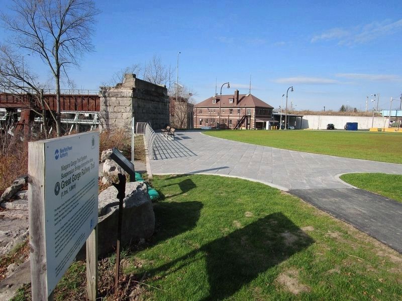
3. Great Gorge Railway Trail Marker
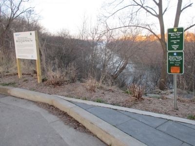
The area by the marker is now called Freedom Park. The area has been landscaped. The approach spans to the abandoned Michigan Central Railway Bridge have been removed. The two long and tall flyover bridges of Robert Moses Parkway, sandwiched between the gorge and Whirlpool Street, have been completely removed.
Credits. This page was last revised on November 9, 2023. It was originally submitted on May 1, 2015, by Anton Schwarzmueller of Wilson, New York. This page has been viewed 571 times since then and 19 times this year. Photos: 1, 2. submitted on May 1, 2015, by Anton Schwarzmueller of Wilson, New York. 3. submitted on November 20, 2020, by Anton Schwarzmueller of Wilson, New York. 4, 5. submitted on May 1, 2015, by Anton Schwarzmueller of Wilson, New York.
