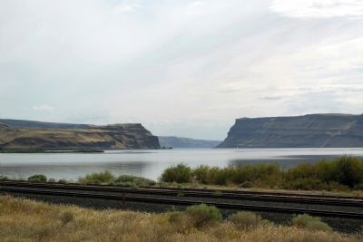
Near Washtucna in Franklin County, Washington — The American West (Northwest)
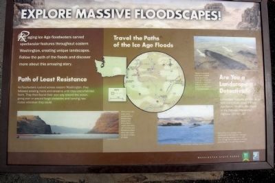
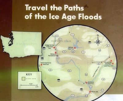
Explore Massive Floodscapes!
Path of Least Resistance
As floodwaters rushed across eastern Washington, they followed existing rivers and streams until they overwhelmed them They then found their own way toward the ocean, going over or around large obstacles and carving new routes wherever they could.
Are You a Landscape Detective?
Landscape features provide us with many clues about the Ice Age floods. What do the shape of the Palouse Hills across Highway 261 tell us?
(Left Photo Caption)
When temporary Lake Lewis pooled behind Wallula Gap, most of the Pasco Basin region, including the Tri-Cities and Sacajawea State Park, was under hundreds of feet of water.
(Center Photo Caption)
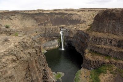
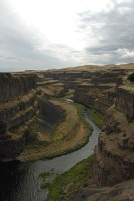
Lyons Ferry Park, located at the confluence of the Snake and Palouse rivers, provides opportunities to see more Ice Age floods features, including great view of Palouse River Canyon.
(Right Photo Caption)
These streamlined hills were sculpted by Ice Age floods. Although not obvious at ground level, their tear-drop shape point in the direction of the floodwaters.
Erected by Washington State Parks.
Topics. This historical marker is listed in this topic list: Natural Features.
Location. 46° 39.822′ N, 118° 13.628′ W. Marker is near Washtucna, Washington, in Franklin County. Marker can be reached from Palouse Falls Road, 2.4 miles west of Washington Highway 261. Marker is located in Palouse Falls State Park at the end of Palouse Falls Road; a entrance fee may be required. Touch for map. Marker is in this post office area: Washtucna WA 99371, United States of America. Touch for directions.
Other nearby markers. At least 6 other markers are within 5 miles of this marker, measured as the crow flies. In the Path of Cataclysmic Floods (here, next to this marker); Stealing a Stream (within shouting distance of this marker); Setting the Stage (about 300 feet away, measured in a direct line); Overwhelming Proof for an "Outrageous" Theory (about 300 feet away); Small Town, Big Voice (about 300 feet away); M - R Military Road (approx. 4.7 miles away).
Also see . . . Palouse Falls - Wikipedia entry. This article also has links to Wikipedia entries on the Columbia River Basalt Group, the Channeled Scablands, and the Missoula Floods. (Submitted on May 6, 2015.)
Credits. This page was last revised on June 16, 2016. It was originally submitted on May 6, 2015, by Duane Hall of Abilene, Texas. This page has been viewed 361 times since then and 11 times this year. Last updated on May 6, 2015, by J. Makali Bruton of Accra, Ghana. Photos: 1, 2, 3, 4. submitted on May 6, 2015, by Duane Hall of Abilene, Texas. 5. submitted on January 29, 2014, by Duane Hall of Abilene, Texas. • Bill Pfingsten was the editor who published this page.
