Kingston, Ontario — Central Canada (North America)
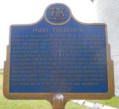
Point Frederick
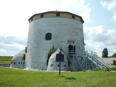
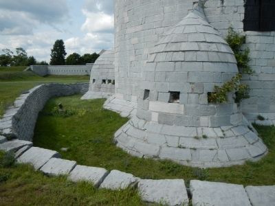
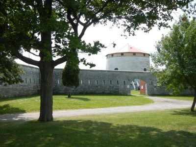
A strategic location for the defence of the Loyalist settlement at Cataraqui (Kingston), this point was reserved in 1788 and named after Sir Frederick Haldimand, Governor of Quebec (1778-86). In 1790-91 a guardhouse and storehouse were built. By 1792 a dockyard was in operation and during the War of 1812 this vital naval base was fortified. On November 10, 1812, the Fort Frederick battery took part in repulsing an American naval squadron under Commodore Isaac Chauncey. This structure, one of four massive stone Martello towers built to strengthen Kingston's defences, was erected in 1846-47 during the Oregon boundary crisis between the United States and Britain. In 1852 the dockyard was closed and in 1870 Fort Frederick was abandoned.
French:
Cette point, lieu stratégique de defense de Cataraqui (Kingston) est réservée en 1788 pour usage militaire et nommée en memoire de Sir Frederick Haldimand, gouverneur de Québec (1778-1786). Un poste de garde et un dépôt y sont construits en 1790-1791 et, vers 1792, un arsenal est en activité. Cette base navale et ensuite fortifiée pendant la guerre de 1812 et le 10 novembre 1812, la batterie de Fort Frederick prend part au refoulement d’une escadre américaine commandée Isaac Chauncey. Ce bâtiment de quatre tours Martello est construit en 1846-1847 pour la defense de Kingston pendant l’affaire de l’Oregon entre les États-Unis et la Grande-Bretagne. En 1852, l’arsenal est fermé et en 1870, le Fort Frederick abandonné.
Erected by Ontario Heritage Foundation, Ministry of Citizenship and Culture.
Topics and series. This historical marker is listed in these topic lists: Forts and Castles • War of 1812. In addition, it is included in the Canada, Ontario Heritage Foundation series list. A significant historical month for this entry is November 1813.
Location. 44° 13.666′ N, 76° 28.166′ W. Marker is in Kingston, Ontario. Marker is on Passchendale Drive. Marker is on the grounds of the Royal Military College of Canada, near the Martello tower inside Fort Frederick. Touch for map. Marker is in this post office area: Kingston ON K7K 7B4, Canada. Touch for directions.
Other nearby markers. At least 8 other markers are within walking distance of this marker. Fort Frederick (within shouting distance of this marker); Commodore’s Residence, 1815 (within shouting distance of this marker); Point Frederick Artillery Battery (about 90 meters away, measured in a direct line); Strategic Importance / Importance Stratégique (about 210 meters away); The Stone Frigate (approx. 0.3 kilometers away); Kingston Navy Yard (approx. 0.3 kilometers away); Sir James Lucas Yeo (approx. 0.3 kilometers away); Point Frederick Buildings (approx. 0.3 kilometers away). Touch for a list and map of all markers in Kingston.
More about this marker. Kingston is independent from the surrounding Frontenac County.
Also see . . . Oregon boundary dispute - Wikipedia. Through these treaties the British and Americans gained residual territorial claims in the disputed area. The remaining portion of the North American Pacific coast contested by the UK and the US was defined as the following: west of the Continental Divide of the Americas, north of Alta California at 42nd parallel north, and south of Russian America at parallel 54°40′ north; typically this region was referred to by the British as the Columbia District and the Oregon Country by the Americans. The Oregon Dispute began to become important in geopolitical diplomacy between the British Empire and the new American Republic, especially after the War of 1812. (Submitted on May 22, 2015, by Barry Swackhamer of Brentwood, California.)
Credits. This page was last revised on March 27, 2024. It was originally submitted on May 22, 2015, by Barry Swackhamer of Brentwood, California. This page has been viewed 315 times since then and 4 times this year. Photos: 1, 2, 3, 4, 5. submitted on May 22, 2015, by Barry Swackhamer of Brentwood, California. • Andrew Ruppenstein was the editor who published this page.
