Mammoth in Yellowstone National Park in Park County, Wyoming — The American West (Mountains)
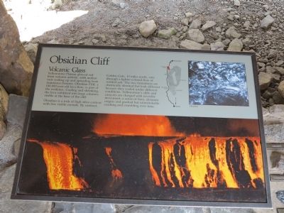
Obsidian Cliff
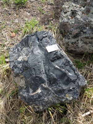
Volcanic Glass
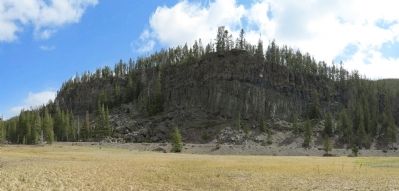
Obsidian is a rock of high silica content with few visible crystals. By contrast, Golden Gate, 10 miles north, cuts through a lighter-colored flow of welded ash. The two formations are chemically identical but look different because they cooled under different conditions. Yellowstone's cliffs and canyons are charged with invisible movement: a sense of fiery, dynamic origin and gradual but unmistakable cracking and crumbling over time.
Topics. This historical marker is listed in these topic lists: Native Americans • Notable Places.
Location. 44° 49.44′ N, 110° 43.752′ W. Marker is in Yellowstone National Park, Wyoming, in Park County. It is in Mammoth. Marker is on Grand Loop Road (U.S. 89), on the right when traveling south. Marker is located about 11 miles south of Mammoth Hot Springs. Touch for map. Marker is in this post office area: Yellowstone National Park WY 82190, United States of America. Touch for directions.
Other nearby markers. At least 8 other markers are within 7 miles of this marker, measured as the crow flies. Roaring Mountain (approx. 3 miles away); Fumaroles (approx. 3 miles away); Sheepeater Cliff (approx. 4.7 miles away); Norris Soldier Station (approx. 6.3 miles away); Living Thermometer (approx. 6.7 miles away); Porcelain Springs (approx. 6.8 miles away); Norris Geyser Basin (approx. 6.8 miles away); a different marker also named Fumaroles (approx. 6.8 miles away). Touch for a list and map of all markers in Yellowstone National Park.
Also see . . . Obsidian Cliff, Prehistoric Lithic Quarry - Wikipedia Article. Obsidian Cliff was an important source of obsidian, prized by Native Americans for making knives, spear points, other lithic tools. Obsidian from this site was first quarried here about 12,000 years ago. Early natives of North America placed a high value on the obsidian that came from this cliff as well as other similar obsidian deposits in the area. Obsidian from Obsidian Cliff was traded and has been found in prehistoric sites as far away as Canada and Ohio. (Submitted on May 23, 2015, by Richard Denney of Austin, Texas.)
Photographed By Richard Denney, May 10, 2015
3. Obsidian Cliff Marker
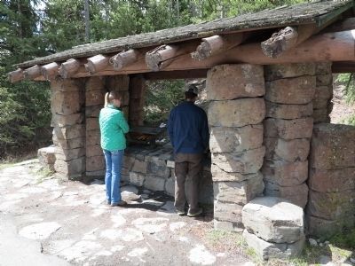
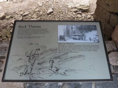
Open-air Museum. This shelter is a Yellowstone landmark. Built in 1931, the structure is one of the first wayside exhibit shelters in the National Park System, and is entered on the National Register of Historic Places. The native logs and stone blend with the environment and create a place to interpret the landscape, not in a museum, but outdoors in plan sight of the natural phenomenon.
Credits. This page was last revised on February 16, 2023. It was originally submitted on May 23, 2015, by Richard Denney of Austin, Texas. This page has been viewed 634 times since then and 34 times this year. Last updated on September 16, 2018, by Craig Baker of Sylmar, California. Photos: 1, 2, 3, 4, 5, 6, 7. submitted on May 23, 2015, by Richard Denney of Austin, Texas. • Bill Pfingsten was the editor who published this page.
