Brutus in Cayuga County, New York — The American Northeast (Mid-Atlantic)
The Erie Canal
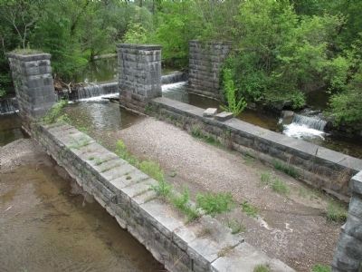
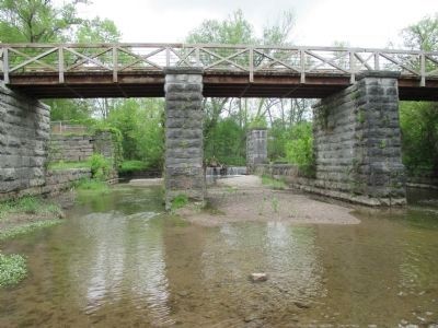
The Centreport Aqueduct
— Centreport Aqueduct Park —
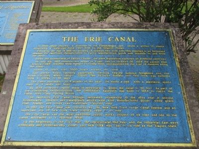
Following the War of 1812 the settling of western New York and Ohio resulted in an increased demand for improved transportation to carry manufactured goods and produce to and from the west.
Under the sponsorship of DeWitt Clinton, the state legislature approved an artificial waterway.
On July 4th, 1817 construction began in Rome, and on October 26, 1825 the packet boat "Seneca Chief" traveled from Buffalo to Sandy Hook accompanied by the roar of cannons along the route.
Within 10 years over 3000 boats worked the canal.
Fast packet boats carrying passengers overtook heavily ladened freighters and line boats carrying mixed cargo. Travel time between Buffalo and New York was reduced from 6 weeks to 10 days.
The canal operated 7 to 9 months of the year, 24 hours a day, with a meximum speed limit of 4 miles an hour.
By 1835 increased traffic made it necessary to widen the canal to 70 feet. As part of the continuing construction, the Centreport Aqueduct was built in 1854 to carry the canal over Cold Spring Brook.
The improved Erie Canal brought increased prosperity to the area that it served. Businessmen, tourists and immigrants moved west with manufactured goods, while grain, coal, lumber and other raw materials traveled east.
In 1917 the Erie Canal was replaced by the New York State Barge Canal System and an important era of New York State history came to an end.
The Erie Canal was the most ambitious public works project of its time and led to the canal movement at a national level.
By the beginning of the Civil War, the agricultural Mid-West and the Industrial East were politically and economically joined and New York was cast in its role as the "Empire State".
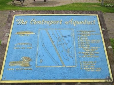
The Centreport Aqueduct
Packet Boat; Typical Farm Bridge; Station, R.S.& E. Railroad.
1. Centreport Aqueduct (1854-1857)
2. Reconstructed Erie Canal (1862-1913)
3. Tow Path
4. Heel Path
5. Farm Bridge (1855-1858)
6. Stone Dam (1854-1857)
7. Earth Dam
8. Farm Pond
9. Rochester, Syracuse & Eastern Railroad (1906-1931)
10. Original Erie Canal (1825-1862)
11. Cold Spring Brook
A. State Route 31
B. Parking Area
C. Picnic Area
D. Interpretive Court (You Are Here)
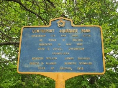
Centreport Aqueduct Park
Supervised for New York State by Town of Brutus. Dedicated 31 May 1975. David E. Coyle, Supervisor. Councilmen Kenneth Weller, James Sullivan, Ernest D. Blumer, Kenneth Spingler. Town of Brutus, 1976.
Topics and series. This historical marker is listed in this topic list: Waterways & Vessels. In addition, it is included in the Erie Canal series list. A significant historical date for this entry is May 31, 1975.
Location. 43° 2.59′ N, 76° 34.556′ W. Marker is in Brutus, New York, in Cayuga County. Marker can be reached from the intersection of New York State Route 31 and West Brutus Street. Marker is at a parking area south off NY Route 31 across from West Brutus Street. Touch for map. Marker is in this post office area: Weedsport NY 13166, United States of America. Touch for directions.
Other nearby markers. At least 8 other markers are within walking distance of this marker. A different marker also named The Erie Canal (a few steps from this marker); The Boom Years (a few steps from this marker); Conduit For Ideas (a few steps from this marker); God's Acre (approx. 0.6 miles away); Weed's Basin (approx. ¾ mile away); Town of Brutus (approx. ¾ mile away); First Baptist Church of Weedsport (approx. ¾ mile away); Firehouse (approx. 0.8 miles away). Touch for a list and map of all markers in Brutus.
Related marker. Click here for another marker that is related to this marker. Marker for Cold Springs Cemetery where Jesse Hawley was buried.
Also see . . .
1. Jesse Hawley - Wikipedia. (Submitted on May 25, 2015, by Anton Schwarzmueller of Wilson, New York.)
2. DeWitt Clinton - Wikipedia
. (Submitted on May 25, 2015, by Anton Schwarzmueller of Wilson, New York.)
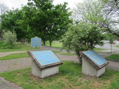
Photographed By Anton Schwarzmueller, May 16, 2015
4. The Erie Canal Marker Inclined at Right
Companion Centreport Aqueduct plaque at left. Parking lot off NY Route 31 at right. The Historic New York series Erie Canal marker is in the background. Beyond the picture at left is a remnant of the Old Erie Canal that leads to the remains of the Centreport Aqueduct.
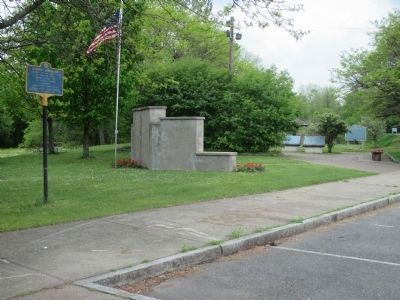
Photographed By Anton Schwarzmueller, May 16, 2015
5. East to West / Left to Right View
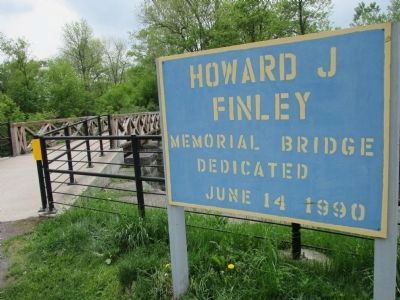
Centreport Aqueduct Park plaque, back of untitled Veterans Memorial, Centreport Aqueduct Map plaque, Erie Canal Marker, the Historic New York series Erie Canal marker, the new towpath bridge sign at extreme right in the distance.
Credits. This page was last revised on June 16, 2016. It was originally submitted on May 25, 2015, by Anton Schwarzmueller of Wilson, New York. This page has been viewed 545 times since then and 33 times this year. Photos: 1, 2, 3, 4, 5, 6, 7, 8. submitted on May 25, 2015, by Anton Schwarzmueller of Wilson, New York.
