Richmond Hill in Bryan County, Georgia — The American South (South Atlantic)
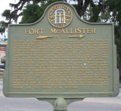
Fort McAllister
»— 10 mi. →
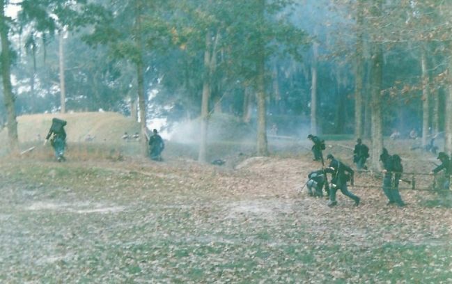
Fort McAllister finally fell on Dec. 13, 1864, when attacked from the rear by Hazen's Division, 15th Corps [Union], which passed this point about 7 A.M. and marched via Bryan Neck road (Ga. 63). Although its commander, Major George W. Anderson, refused to surrender, all resistance was smothered under waves of Union infantry which the small garrison of 230 officers and men could not long resist. The fall of Fort McAllister opened the Great Ogeechee River to Union supply ships and enabled Gen. Sherman to establish a base at King's Bridge. From it, he could supply his whole army (about 60,000 men) which, after a 300 mile march from Atlanta, was then closing in on Savannah.
Erected 1957 by Georgia Historical Commission. (Marker Number 015-6.)
Topics and series. This historical marker is listed in these topic lists: Notable Places • War, US Civil. In addition, it is included in the Battlefield Trails - Civil War, the Georgia Historical Society, and the Sherman’s March to the Sea series lists. A significant historical date for this entry is December 13, 1864.
Location. 31° 56.978′ N, 81° 18.732′ W. Marker is in Richmond Hill, Georgia, in Bryan County. Marker is at the intersection of Ford Avenue (State Highway 144) and Coastal Highway (U.S. 17), on the right when traveling east on Ford Avenue. Touch for map. Marker is in this post office area: Richmond Hill GA 31324, United States of America. Touch for directions.
Other nearby markers. At least 8 other markers are within walking distance of this marker. "Dead Town" of Hardwicke (here, next to this marker); Courthouse Annex (about 400 feet away, measured in a direct line); Ways Station (approx. 0.4 miles away); Richmond Hill Veterans Monument (approx. 0.4 miles away); Jack Fleming Gregory, Senior (approx. half a mile away); a different marker also named Ways Station (approx. half a mile away); J. F. Gregory (approx. half a mile away); Robert E. Lee (approx. half a mile away). Touch for a list and map of all markers in Richmond Hill.
Related markers. Click here for a list of markers that are related to this marker. Fort McAllister Virtual Tour by Markers
Also see . . .
1. The First Battle of Fort McAllister took place March 3, 1863. (Submitted on June 18, 2008, by Mike Stroud of Bluffton, South Carolina.)
2. The Second Battle of Fort McAllister. took place December 13, 1864, during the final stages of Maj. Gen. William T. Sherman's March to the Sea (Submitted on June 18, 2008, by Mike Stroud of Bluffton, South Carolina.)
Credits. This page was last revised on March 12, 2019. It was originally submitted on June 18, 2008, by Mike Stroud of Bluffton, South Carolina. This page has been viewed 2,882 times since then and 33 times this year. Photos: 1. submitted on January 11, 2009, by Mike Stroud of Bluffton, South Carolina. 2. submitted on June 18, 2008, by Mike Stroud of Bluffton, South Carolina. 3. submitted on June 18, 2008, by Craig Swain of Leesburg, Virginia. 4. submitted on June 18, 2008, by Mike Stroud of Bluffton, South Carolina. • Craig Swain was the editor who published this page.


