Waterfront in Buffalo in Erie County, New York — The American Northeast (Mid-Atlantic)
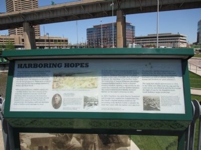
Harboring Hopes
Inscription.
There was fierce competition between Buffalo and Black Rock for the Canal's western terminus. Albany, the link to New York City, emerged as the perfect choice for the eastern end of the Canal. The western end was a far less obvious proposition. Three miles of dense forest separated the two leading contenders, Buffalo and Black Rock.
With no natural harbor, shallow waters and a sandbar, Buffalo was not a logical choice. Somewhat sheltered from lake winds and benefiting from the natural rock formation after which it was named, Black Rock already boasted more commerce than Buffalo. By inexpensively developing a safe a workable harbor, Buffalo could overtake its rival.
All images courtesy of the Buffalo and Erie County Historical Society.
Buffalo Harbor from Exchange Buildings. George Smith, Drawing, September 1829.
Judge Samuel Wilkeson. Reverend Albert Bigelo, 1850 ca. Oil on canvas.
"I remember being perched on my father's shoulders as he waded across the mouth of Buffalo Creek in superintendence of the crib-laying, and being startled by the bugle-tone power of the magnetic voice which gave commands to his men as he walked."
Samuel Wilkeson Jr. reflects upon his father, Judge Samuel Wilkeson.
In 1819, nine villagers formed the first local businessmen's association, the Buffalo Harbor Company. Pledging their personal resources to gain a state loan of $12,000, they attempted to answer the challenge of the harbor. Under the leadership of Samuel Wilkeson, the village dammed Buffalo Creek to create a new channel across a sandbar, opening a new mouth for the creek that connected with the harbor entrance. The Canal Commissioners finally declared Buffalo as the canal's terminus in 1821.
In 1825, Thaddeus Joy, with Charles Townsend and George Coit, created the Commercial Slip, the Canal's original western terminus, by excavating Little Buffalo Creek to connect the main line canal with the harbor and Lake Erie.
Commercal Slip looking towards the city.
Commercial Street Bridge, Photograph, ca. 1870.
The area was a center of commerce and banking from the 1830s to the 1880s, and remained the home of light manufacturing businesses as well as saloons, boarding houses and brohels for years afterward.
The canal was rebuilt and rerouted in 1918. In the 1920s and 1930s both the slip and the canal nearby were filled in and the slip became the right of way for the Hamburg drain, South Buffalo's major sewer line.
Even after the Commercial Slip was filled in, this area remained the point of departure for passenger cruise services into the 1960s. The Canadiana, on the left, offered day trips to Crystal Beach amusement
park on the Canadian shore.
Cruise vessels Docked in the Inner Harbor, Photograph, ca. 1950.
Topics and series. This historical marker is listed in this topic list: Waterways & Vessels. In addition, it is included in the Erie Canal series list. A significant historical year for this entry is 1819.
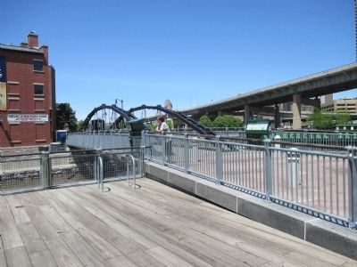
Location. 42° 52.632′ N, 78° 52.754′ W. Marker is in Buffalo, New York, in Erie County. It is in Waterfront. Marker is at the intersection of Lloyd Street and Prime Street, on the left when traveling east on Lloyd Street. Marker is at the southeast end of a pedestrian bridge over the rebuilt Commercial Slip. Touch for map. Marker is in this post office area: Buffalo NY 14202, United States of America. Touch for directions.
Other nearby markers. At least 8 other markers are within walking distance of this marker. Rebirth & Renewal (here, next to this marker); The Ruins at Canalside (within shouting distance of this marker); William Wells Brown (within shouting distance of this marker); Wedding of the Waters (within shouting distance of this marker); The Big Picture (within shouting distance of this marker); God Honor and Country (within shouting distance of this marker); In Recognition of Long and Faithful Service (within shouting distance of this marker); 106th Field Artillery Regiment (within shouting distance of this marker). Touch for a list and map of all markers in Buffalo.
Also see . . .
1. SS Canadiana - Wikipedia. As depicted and mentioned at the end of the marker text. (Submitted on June 18, 2015, by Anton Schwarzmueller of Wilson, New York.)
2. Samuel Wilkeson - Wikipedia. (Submitted on June 18, 2015, by Anton Schwarzmueller of Wilson, New York.)
Credits. This page was last revised on February 16, 2023. It was originally submitted on June 18, 2015, by Anton Schwarzmueller of Wilson, New York. This page has been viewed 385 times since then and 13 times this year. Photos: 1, 2, 3, 4. submitted on June 18, 2015, by Anton Schwarzmueller of Wilson, New York.


