Tobyhanna Township near Pocono Summit in Monroe County, Pennsylvania — The American Northeast (Mid-Atlantic)
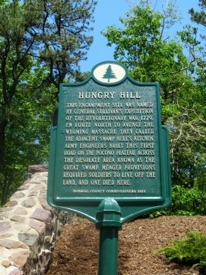
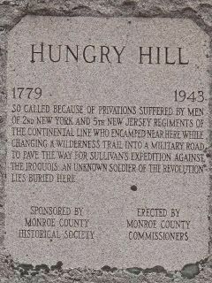
Hungry Hill Memorial
Sullivan's Expedition
Erected 2013 by Monroe County Commissioners.
Topics and series. This historical marker and memorial is listed in these topic lists: Cemeteries & Burial Sites • War, US Revolutionary. In addition, it is included in the Pennsylvania History Tour, Tobyhanna Township, and the The Sullivan-Clinton Expedition Against the Iroquois Indians series lists. A significant historical year for this entry is 1779.
Location. 41° 6.366′ N, 75° 26.633′ W. Marker is near Pocono Summit, Pennsylvania, in Monroe County. It is in Tobyhanna Township. Marker is on Sullivan Trail (Pennsylvania Route 4004) half a mile south of PA Route 940 (Pennsylvania Route 940) when traveling north. Touch for map. Marker is at or near this postal address: 135 Sullivan Trail, Pocono Summit PA 18346, United States of America. Touch for directions.
Other nearby markers. At least 8 other markers are within 2 miles of this marker, measured as the crow flies. Hungry Hill Revolutionary War Monument (a few steps from this marker); Wilkes-Barre and Eastern Railroad (approx. 0.3 miles away); Naomi Pines House (approx. 0.6 miles away); Pocono Pines Assembly (approx. 0.9 miles away); Lutherland (approx. 1.1 miles away); The Linnie Lee (approx. 1.2 miles away); Summer Youth Camps (approx. 1.3 miles away); Ice Harvesting Industry (approx. 1.3 miles away). Touch for a list and map of all markers in Pocono Summit.
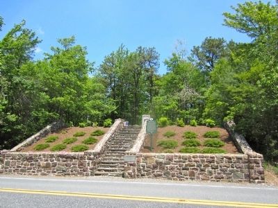
More about this memorial. Marker is at the Revolutionary War Memorial and gravesite of the Unknown Soldier of the Revolutionary War.
Also see . . . Hungry Hill Memorial Dedication Site. (Submitted on June 27, 2017, by Rick Bodenschatz of Pocono Pines, Pennsylvania.)
Credits. This page was last revised on December 1, 2023. It was originally submitted on June 20, 2015, by Rick Bodenschatz of Pocono Pines, Pennsylvania. This page has been viewed 1,070 times since then and 33 times this year. Last updated on June 21, 2015, by Rick Bodenschatz of Pocono Pines, Pennsylvania. Photos: 1. submitted on June 20, 2015, by Rick Bodenschatz of Pocono Pines, Pennsylvania. 2. submitted on June 21, 2015, by Rick Bodenschatz of Pocono Pines, Pennsylvania. 3. submitted on June 20, 2015, by Rick Bodenschatz of Pocono Pines, Pennsylvania. • Bill Pfingsten was the editor who published this page.


