Myrtle Beach in Horry County, South Carolina — The American South (South Atlantic)
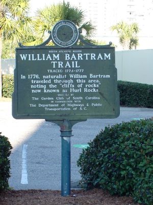
William Bartram Trail
Traced 1773–1777
— South Atlantic Region —
Erected by The Garden Club of South Carolina in cooperation with The Department of Highways & Public Transportation of S.C.
Topics and series. This historical marker is listed in this topic list: Natural Features. In addition, it is included in the William Bartram Trails series list. A significant historical year for this entry is 1776.
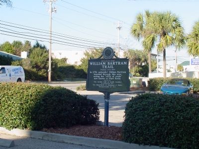
Location. 33° 40.183′ N, 78° 54.317′ W. Marker is in Myrtle Beach, South Carolina, in Horry County. Marker is at the intersection of Ocean Boulevard (State Highway 73) and South 20th Avenue, on the right when traveling north on Ocean Boulevard. Touch for map. Marker is in this post office area: Myrtle Beach SC 29577, United States of America. Touch for directions.
Other nearby markers. At least 8 other markers are within walking distance of this marker. Major General Joseph J. Kruzel (approx. 0.7 miles away); Major General Gilbert L. Meyers (approx. ¾ mile away); Colonel Franklin Harold Scott (approx. 0.8 miles away); Colonel Robert Lindsay Petit (approx. 0.9 miles away); Colonel Francis S. Gabreski (approx. 0.9 miles away); Whispering Pines Golf Course (approx. 0.9 miles away); Colonel Herbert E. Ross (approx. 0.9 miles away); Colonel Richard (Rick) H. McDow (approx. 0.9 miles away). Touch for a list and map of all markers in Myrtle Beach.
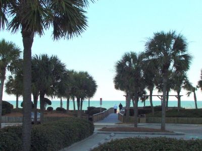
More about this marker. The marker is at Hurl Rock Park, on the beach. The black rock outcroppings can at times be seen on the white sand beach.
Also see . . .
1. Books about William Bartram and his travels. on Amazon.com. (Submitted on February 8, 2007.)
2. Herl/Hurl Rocks article at Horry County Historical Society website. A photo of the rocks (dark colored coquina) from 1940 is included in this page. (Submitted on January 19, 2024.)
Credits. This page was last revised on January 19, 2024. It was originally submitted on February 8, 2007, by J. J. Prats of Powell, Ohio. This page has been viewed 2,445 times since then and 51 times this year. Photos: 1, 2, 3. submitted on February 8, 2007, by J. J. Prats of Powell, Ohio.


