Near Bodega Bay in Sonoma County, California — The American West (Pacific Coastal)
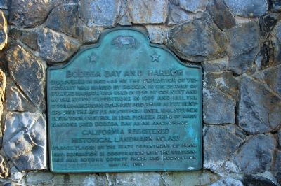
Bodega Bay and Harbor
California Registered Historical Landmark No. 833
Plaque placed by the State Department of Parks and Recreation in cooperation with the Westerners and Sonoma County Parks and Recreation.
May 24, 1970
Erected 1970 by California State Department of Parks and Recreation in cooperation with the Westerners and Sonoma County Parks and Recreation. (Marker Number 833.)
Topics and series. This historical marker is listed in these topic lists: Government & Politics • Settlements & Settlers • Waterways & Vessels. In addition, it is included in the California Historical Landmarks series list. A significant historical month for this entry is May 1711.
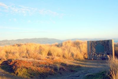
Location. 38° 18.68′ N, 123° 3.067′ W. Marker is near Bodega Bay, California, in Sonoma County. Marker is on Doran Beach Road west of California Route 1, on the left when traveling west. Located inside Doran Regional Park (http://www.sonoma-county.org/parks/pk_doran.htm). Touch for map. Marker is in this post office area: Bodega Bay CA 94923, United States of America. Touch for directions.
Other nearby markers. At least 5 other markers are within 7 miles of this marker, measured as the crow flies. The Children's Bell Tower (approx. 2 miles away); Bodega Bay (approx. 4.8 miles away); Church of Saint Teresa of Avila (approx. 4.9 miles away); Potter School Est. 1873 (approx. 4.9 miles away); Watson School (approx. 6.8 miles away).
Also see . . . Doran Regional Park. (Submitted on February 9, 2007.)
Credits. This page was last revised on November 8, 2019. It was originally submitted on February 9, 2007, by Karen Key of Sacramento, California. This page has been viewed 2,081 times since then and 27 times this year. Photos: 1. submitted on February 9, 2007, by Karen Key of Sacramento, California. 2. submitted on October 21, 2014, by Henry M Kohnen of San Jose, California. 3, 4. submitted on February 9, 2007, by Karen Key of Sacramento, California. • J. J. Prats was the editor who published this page.


