Near Guernsey in Platte County, Wyoming — The American West (Mountains)
Forts, Stations, and Camps
Inscription.
Two plaque, under the same name, described military forts and stations on the Wyoming's Platte River section of the Oregon Trail.
Panel 1:
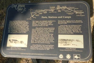
There were four forts, numerous stations, and camps along the Oregon-California-Mormon Trails in Wyoming during the mid-1800s. In 1849, Fort Laramie was specifically established to protect emigrants travelling west. The post was abandoned on March 2, 1890. Fort Clay was established October 1855 and predesignated Camp Davis February 1856. Fort Bridger was purchased in 1858 and closed November 6, 1890.
Fort Casper was originally established in May 1862, and named Platte Bridge Station. It was designated a fort November 21, 1856 and was officially abandoned October 19, 1867.
Most military camps and stations were established near Pacific Telegraph stations located near rivers, creeks, and springs. The soldiers at those stations were responsible for protecting emigrants, delivering mail, protecting and repairing the telegraph line. All stations were constructed by the 11th Ohio Volunteer Cavalry Regiment from 1862 two 1864. Buildings were constructed of logs or sod and had dirt or wood floors. All stations had enclosed corrals. Tents were also used for housing.
Camp Marshall, had wood buildings and was located just east of La Bonte Creek Station. It was established by E Company, 2nd Battalion in 1864. Named after Capt. Levi G. Marshall, the camp was officially abandoned in the Spring of 1866.
Camp Dodge was established April 1865 by the 11th Kansas Volunteer Cavalry Regiment, four miles east of Platte Bridge Station, on present day Garden Creek, Casper Wyoming. It was composed of tents. The camp was abandoned in June 1865."
Panel 2:
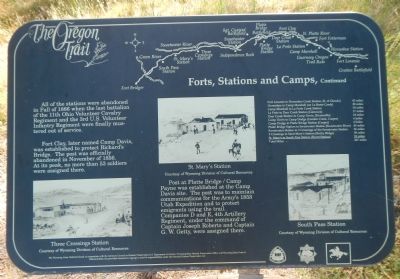
All of the stations were abandoned in the Fall of 1866 when the last battalion of the of the 11th Ohio Volunteer Cavalry Regiment and the 3rd U.S. Volunteer Infantry Regiment were finally mustered out of service.
Fort Clay, later named Camp Davis, was later established to protect Richard’ s Bridge. The post was officially abandoned in November of 1856. At its peak, no more than 53 soldiers were assigned there.
The post at Platte Bridge / Camp Payne was established at the Camp Davis site. The post was to maintain communication for the Army’s 1858 Utah Expedition and to protect emigrants using the trail. Companies D and E, 4th Artillery Regiment, under the command of Captain Joseph Roberts and Captain G.W. Getty were assigned there.
Fort Laramie to Horseshoe Creek Station, (S. of Gendo) - 43 miles • Horseshoe to Camp Marshall (on La Bonte Creek) - 20 miles
• Camp Marshal to La Prele Creek Station - 18 miles • La Prele to Deer Creek Station - 17 miles • Deer Creek Station to Camp Davis (Evansville) 24 miles • Camp Davis to Camp Dodge (Garden Creek, Casper) - 4 miles • Camp Dodge to Platte Bridge Station (Casper) - 4 miles • Platte Bridge Station to Sweetwater Station (Sweetwater River) - 45 miles • Sweetwater Station to 3 Crossings of the Sweetwater Station - 36 miles • 3 Crossings to Saint Mary's Station (Rocky Ridge) 38 miles • St. Mary's to South Pass Station ( Burnt Station) 18 miles • Total Miles - 267 miles
Erected by The Wyoming National Guard, in cooperation with the Advisory Council on Historic Preservation, U.S. Department of the Interior, Wyoming State Historic Preservation Office, ad Wyoming State Parks and Historic Sites.
Topics and series. This historical marker is listed in these topic lists: Forts and Castles • Roads & Vehicles. In addition, it is included in the Oregon Trail series list. A significant historical year for this entry is 1849.
Location. 42° 15.408′ N, 104° 44.936′ W. Marker is near Guernsey, Wyoming, in Platte County. Marker can be reached from Lucinda Rollins Road near South Guernsey Road, on the left when traveling west. Touch for map. Marker is in this post office area: Guernsey WY 82214, United States of America. Touch for directions.
Other nearby markers. At least 8 other markers are within walking
distance of this marker. The United States Army and the Oregon Trail (a few steps from this marker); Oregon Trail Ruts (a few steps from this marker); Oregon Trail Ruts State Historic Site (a few steps from this marker); The US Army’s Role in Protecting the Oregon Trail is Best Described by the Soldiers (within shouting distance of this marker); a different marker also named Oregon Trail Ruts (about 300 feet away, measured in a direct line); Encampments in the Guernsey Area (about 400 feet away); Grave of Lucindy Rollins (approx. 0.3 miles away); Laramie Peak (approx. 0.9 miles away). Touch for a list and map of all markers in Guernsey.
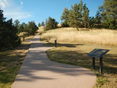
More about this marker. These plaques are located in Oregon Trail Ruts State Historic Site on the path leading from the parking lot to the Oregon Trail Ruts.
Credits. This page was last revised on June 14, 2020. It was originally submitted on July 19, 2015, by Barry Swackhamer of Brentwood, California. This page has been viewed 573 times since then and 42 times this year. Photos: 1, 2, 3, 4. submitted on July 19, 2015, by Barry Swackhamer of Brentwood, California. • Andrew Ruppenstein was the editor who published this page.


