Richmond in Madison County, Kentucky — The American South (East South Central)
Manson's Mistake
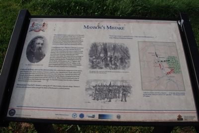
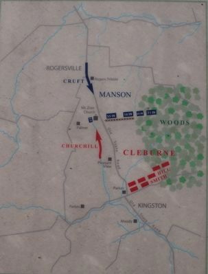
The standard tactic employed in a Civil War battle was to turn your opponent's flank, that is, to bring your line of infantry into position perpendicular to the enemy's, giving the flanking soldiers an advantage in firepower. Gen. Mahlon Manson, deployed his brigade in textbook fashion, placing his men in line of battle with his four infantry regiments separated by artillery.
Confederate Gen. Patrick Cleburne positioned most of his infantry east of the Old State road (US 421), his line extending on the east to a stand of woods. Manson, who could not see the entire Confederate line, moved his men forward to determine just where Cleburne's line ended. This action led to an exchange of fire and continuous shifting of troops by both sides. Manson, believing that the Confederates would try to turn his flank, sent his reserve, the 71st Indiana, and seven of the ten companies of the 69th Indiana, to the east to lengthen and strengthen his line. Unfortunately, Manson seriously misjudged the Confederates.
Cleburne skillfully allowed the drama to play out, continuing the engagement at the eastern end of Manson's line. In the meantime, Cleburne's superior, Gen. Edmund Kirby Smith, ordered Gen. Thomas James Churchill to move his division to the west of the Union line. Churchill moved his men through the draw created by Mound Creek without being detected by Manson, bringing his men back onto the field between the Palmer House and Mt. Zion Church. When Churchill deployed in the line of battle the Confederates had flanked the Union right. As Churchill emerged from the draw, Cleburne ordered an assault on the Union center.
Manson met Churchill's threat by ordering the 95th Ohio to make a bayonet charge. Manson's mistake, and subsequent orders, brought the Battle of Richmond to a critical juncture.
Topics. This historical marker is listed in this topic list: War, US Civil.
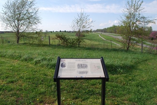
Location. 37° 40.016′ N, 84° 15.006′ W. Marker is in Richmond, Kentucky, in Madison County. Marker can be reached from the intersection of Battlefield Memorial Highway (U.S. 421) and Hays Fork Lane, on the right when traveling south. Touch for map. Marker is at or near this postal address: 101 Battlefield Memorial Hwy, Richmond KY 40475, United States of America. Touch for directions.
Other nearby markers. At least 8 other markers are within walking distance of this marker. A Near Fatal Mistake (about 300 feet away, measured in a direct line); "The Loud Mouthed Dogs of War Were Unleashed" (about 400 feet away); Sharpshooters Check The Union Right (about 600 feet away); A Reckless And Useless Charge (about 600 feet away); Barnett Burial Ground (about 600 feet away); The Union Trail (approx. 0.2 miles away); Saving the Richmond Battlefield (approx. 0.2 miles away); "Good, Common-Sense Soldiering" (approx. 0.2 miles away). Touch for a list and map of all markers in Richmond.
Credits. This page was last revised on October 5, 2019. It was originally submitted on July 26, 2015, by Brandon Fletcher of Chattanooga, Tennessee. This page has been viewed 340 times since then and 11 times this year. Last updated on October 1, 2019, by Bradley Owen of Morgantown, West Virginia. Photos: 1, 2, 3, 4. submitted on July 26, 2015, by Brandon Fletcher of Chattanooga, Tennessee. • J. Makali Bruton was the editor who published this page.


