Hanover in York County, Pennsylvania — The American Northeast (Mid-Atlantic)
The Forney Farms
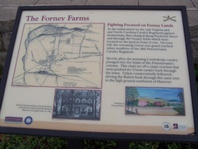
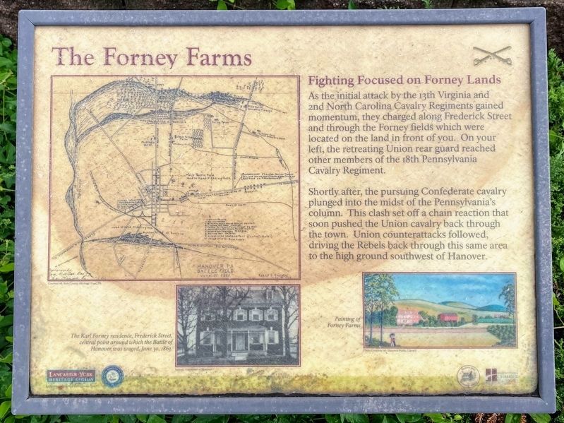
Fighting Focused on Forney Lands
Shortly after, the pursuing Confederate cavalry plunged into the midst of the Pennsylvania's column. This clash set off a chain reaction that soon pushed the Union cavalry back through the town. Union counterattacks followed, driving the Rebels back through this same area to the high ground southwest of Hanover.
Topics and series. This historical marker is listed in this topic list: War, US Civil. In addition, it is included in the Pennsylvania, Battle of Hanover Walking Tour series list.
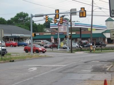
Location. 39° 47.746′ N, 76° 59.317′ W. Marker is in Hanover, Pennsylvania, in York County. Marker is at the intersection of Frederick Street (Pennsylvania Route 194) and Forney Avenue, on the right when traveling east on Frederick Street. Touch for map. Marker is in this post office area: Hanover PA 17331, United States of America. Touch for directions.
Other nearby markers. At least 8 other markers are within walking distance of this marker. The Center of the Storm (within shouting distance of this marker); Hanover (about 600 feet away, measured in a direct line); J.E.B. Stuart's Jump (approx. 0.2 miles away); The Winebrenner House (approx. 0.2 miles away); Search and Destroy, Hide and Seek (approx. 0.2 miles away); Gettysburg Campaign (approx. ¼ mile away); The Confederates Invade Pennsylvania (approx. ¼ mile away); Stuart's Fruitless Odyssey (approx. ¼ mile away). Touch for a list and map of all markers in Hanover.
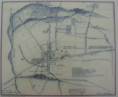
More about this marker. In the upper left is a map of the Hanover PA Battlefield June 30, 1863. Below the map is a photo of The Karl Forney residence, Frederick Street, central point around which the Battle of Hanover was waged, June 30, 1863. In the lower right is a Painting of Forney Farms.
Credits. This page was last revised on December 25, 2021. It was originally submitted on June 29, 2008, by Bill Pfingsten of Bel Air, Maryland. This page has been viewed 2,694 times since then and 136 times this year. Photos: 1. submitted on June 29, 2008, by Bill Pfingsten of Bel Air, Maryland. 2, 3. submitted on July 3, 2008, by Craig Swain of Leesburg, Virginia. 4. submitted on December 19, 2021, by Shane Oliver of Richmond, Virginia.


