Plaquemine in Iberville Parish, Louisiana — The American South (West South Central)
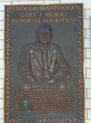
Gary J. Hebert Memorial Lockhouse
1929-1994
Erected 1995.
Topics. This historical marker is listed in these topic lists: Bridges & Viaducts • Waterways & Vessels.
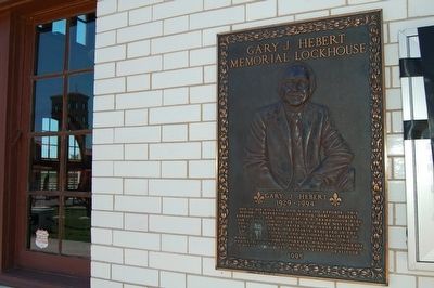
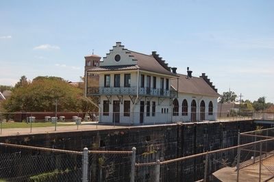
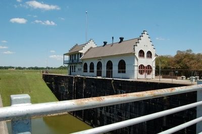
Location. 30° 17.554′ N, 91° 14.064′ W. Marker is in Plaquemine, Louisiana, in Iberville Parish. Marker can be reached from Main Street east of Church Street, on the right when traveling west. Mounted to side of Lock House. Touch for map. Marker is at or near this postal address: 57730 Main Street, Plaquemine LA 70764, United States of America. Touch for directions.
Other nearby markers. At least 8 other markers are within 3 miles of this marker, measured as the crow flies. Bayou Plaquemine (a few steps from this marker); Old City Hall (about 300 feet away, measured in a direct line); Academy of Saint Basil (approx. 0.2 miles away); Plaquemine First United Methodist Church (approx. ¼ mile away); a different marker also named Bayou Plaquemine (approx. 0.3 miles away); Plaquemine Tribe World War 1 Memorial Tablet (approx. 0.3 miles away); a different marker also named Bayou Plaquemine (approx. 2.1 miles away); Morrisonville (approx. 2.3 miles away). Touch for a list and map of all markers in Plaquemine.
Related markers. Click here for a list of markers that are related to this marker. To better understand the relationship, study each marker in the order shown.
Also see . . . Future Historical Marker at the Plaquemine Lockhouse. Title of the marker: Bernardo De Galvez March to Fort Manchac on the Mississippi River (Submitted on July 6, 2018, by Kenneth Ramagost of Unknown, Louisiana.)
Photographed By Kenneth Ramagost
5. Gary J. Hebert Memorial Lockhouse is also in the area of an American Revolution War event
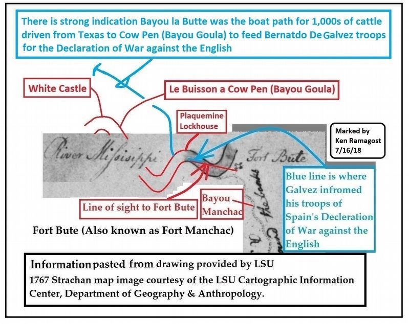
In the area of Plaquemine Lockhouse (considering the Mississippi River moved over the years) is where an historic event took place in 1779, Bernardo de Gálvez informed his troops of the Spanish Declaration of War against the English and they cheered, attacking the English a few miles upstream at Fort Bute (Fort Manchac). Fourteen hundred and thirty men including 80 free Blacks and 160 Indians marched with Gálvez. These troops marched on both sides of the river with Gálvez on the east bank and were accompanied by one schooner with three gunboats. Next, they moved north to the Battle of Baton Rouge and this march was the Western Front of the American Revolution in the Mississippi River Valley including 5 states of the Northwest Territories bordering the Great Lakes. His troops were fed with 10,000 cattle driven from Texas and there is a strong indication many were penned a few miles south of what is now known as Bayou Goula, then called Cow Pen as shown in a 1775 map. See historical marker Bayou Goula (item 4) map showing the original name of Bayou Goula. Also Continental Congress Agent Oliver Pollock joined with Gálvez before his attack of Fort Manchac and planned with Gálvez many of his military attacks. See Oliver Pollock Historical Marker item 5 showing he contributed nearly $1 billion in today's money to help fight in the Northwest Territories with him becoming financially broke and jailed in a Caribbean island. A must-read very sad story of this American Revolutionary hero, Gálvez paid to release Mr. Pollock out of Jail.
Credits. This page was last revised on February 24, 2024. It was originally submitted on August 8, 2015. This page has been viewed 588 times since then and 32 times this year. Photos: 1, 2, 3, 4. submitted on August 8, 2015. 5. submitted on August 3, 2018, by Kenneth Ramagost of Unknown, Louisiana. • Bernard Fisher was the editor who published this page.
