Glasgow in Barren County, Kentucky — The American South (East South Central)
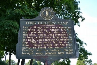
Long Hunters' Camp
Erected 1964 by Kentucky Historical Society and Kentucky Department of Highways. (Marker Number 635.)
Topics and series. This historical marker is listed in these topic lists: Colonial Era • Exploration • Industry & Commerce • Settlements & Settlers. In addition, it is included in the Kentucky Historical Society series list. A significant historical year for this entry is 1769.
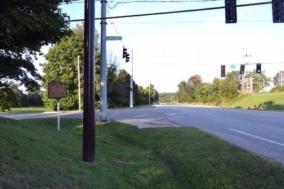
Location. 37° 0.862′ N, 85° 54.941′ W. Marker is in Glasgow, Kentucky, in Barren County. Marker is at the intersection of U.S. 31 E and Lexington Drive, on the right when traveling south on U.S. 31 E. Marker is at west corner of intersection. Touch for map. Marker is in this post office area: Glasgow KY 42141, United States of America. Touch for directions.
Other nearby markers. At least 8 other markers are within 2 miles of this marker, measured as the crow flies. Fort Williams (approx. 1.2 miles away); Glasgow Municipal Cemetery (approx. 1.2 miles away); General Joseph H. Lewis (approx. 1.3 miles away); Defending Glasgow (approx. 1.3 miles away); Attack on Fort Williams (approx. 1.3 miles away); a different marker also named Fort Williams (approx. 1.3 miles away); Barren County Korean Conflict Memorial (approx. 1.3 miles away); Barren County Viet Nam Memorial (approx. 1.3 miles away). Touch for a list and map of all markers in Glasgow.
Also see . . . Henry Scaggs - Wikipedia entry. (Submitted on August 31, 2015.)
Credits. This page was last revised on June 16, 2016. It was originally submitted on August 31, 2015, by Duane Hall of Abilene, Texas. This page has been viewed 724 times since then and 85 times this year. Photos: 1, 2, 3, 4. submitted on August 31, 2015, by Duane Hall of Abilene, Texas.


