Avalon in Baltimore County, Maryland — The American Northeast (Mid-Atlantic)
Forging Freedom and Nails
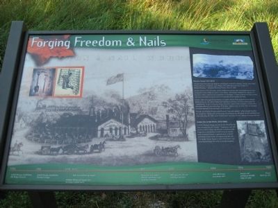
"At that time there were two Negroes belonging to Edward H. Dorsey, a Negro man called Prince, who was a forgeman, and a Negro man called Sam who was a striker in a Blacksmith shop." - Maryland Chancery Papers, May 17, 1787.
An abundance of iron ore, trees, oysters shells and running water encouraged some tobacco planters of the 1700s to invest in iron making - the Patapsco Valley's first industry. On this site in 1761, Caleb Dorsey established an iron forge - a water-powered mill that worked iron into marketable products such as horseshoes, shove spades, and nails.
Chronic labor shortages forced Dorsey to transfer several black slaves from his tobacco fields to the iron mill. More skilled that field slaves, Dorsey's iron slaves were given the "opportunity" to earn money by doing extra work. Despite this concession, it still took a Herculean effort to take advantage of Dorsey's "opportunity." In June 1764, for example, one slave earned 7 pounds for cutting 67 cords of wood.
Though some slaves thrived under Dorsey's "overwork system," others sought freedom by saving their money and running away. According to the Maryland Jounal and Baltimore Advertiser May 29, 1781, when another slave ran away, he had "plenty of money with him."
Avalon Iron & Nail Works (1815-1868):
In 1815, Dorsey's Forge was sold to the Ellicott family, who renamed the mill "Avalon." Employing over 100 workers and no slaves, the ellicotts transformed the forge into a nail factory. A small company-owned town of several houses, a general store, a church and (later) a train station emerge around the mill. The Avalon Visitor Center is one of the town's two surviving buildings. The other is provate property.
Text with upper left drawing: (Illustration by Brian Albright, 2006).
Timeline:
1755 - Caleb Dorsey establishes Elk Ridge Furnace
1761 - Caleb Dorsey establishes Dorsey's Forge
1775 - William Whetcroft leases mill to forge musket parts
1777 - Nail manufacturing begins
1815 - Benjamin and James Ellicott purchase forge, rename it Avalon
1820 - Mill operates 24 nail making machines
1848 - John McCrone puchases mill
1856 - Avalon mill produces 44,000 kegs of nails
1868 - Flood destoys mill
Erected by Maryland Department of Natural Resources, Chesapeake Bay Gateways Network.
Topics. This historical marker is listed in these topic lists: African Americans • Colonial Era • Industry & Commerce • War, US Revolutionary. A significant historical date for this entry is May 17, 1787.
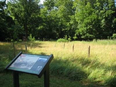
Location. 39° 13.651′ N, 76° 43.249′ W. Marker is in Avalon, Maryland, in Baltimore County. Marker can be reached from the intersection of Washington Boulevard (U.S. 1) and South Street. Marker is within the Patapsco Valley State Park - Avalon area, on the northern side of the Patapsco River. Marker is about 100 yards along footpath from Avalon Visitor Center parking lot which is just under 1 mile from the park gate building. Entrance to PVSP is about 300 feet north of the US 1 - South Street intersection. Touch for map. Marker is in this post office area: Halethorpe MD 21227, United States of America. Touch for directions.
Other nearby markers. At least 8 other markers are within walking distance of this marker. Drinking Water for the Public (within shouting distance of this marker); The Baltimore County Water and Electric Company (within shouting distance of this marker); Powering the Patapsco Valley's Industries (about 300 feet away, measured in a direct line); A Place For Progress (about 300 feet away); Iron Builds America (about 300 feet away); Elkridge Landing (about 600 feet away); The C.C.C. Builds Our Park (about 700 feet away); Patapsco Valley State Park (approx. 0.2 miles away). Touch for a list and map of all markers in Avalon.
Credits. This page was last revised on June 16, 2016. It was originally submitted on July 5, 2008, by F. Robby of Baltimore, Maryland. This page has been viewed 1,452 times since then and 30 times this year. Photos: 1, 2. submitted on July 5, 2008, by F. Robby of Baltimore, Maryland.

