Mammoth in Yellowstone National Park in Park County, Wyoming — The American West (Mountains)
An Exploded Bay
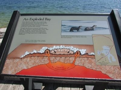
West Thumbís shoreline has suspiciously crater-like contours. Its underwater profile is dramatically deeper than the rest of Yellowstone Lake. Only a massive explosion could have formed West Thumb.
Though the blowout occurred 125,000 years ago, West Thumb is still thermally active. Hot springs, mudpots, and geysers steam and percolate along the shore, and temperature gauges record high heat flow in the lake bottom sediments.
In winter, holes in the thick ice indicate hot spots in the lake bed where thermal features bubble up. Otters often fish in those melt holes.
Erected by National Park Service.
Topics. This historical marker is listed in this topic list: Waterways & Vessels.
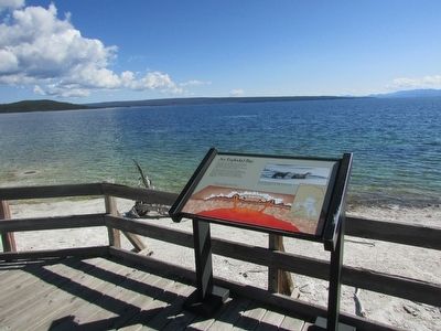
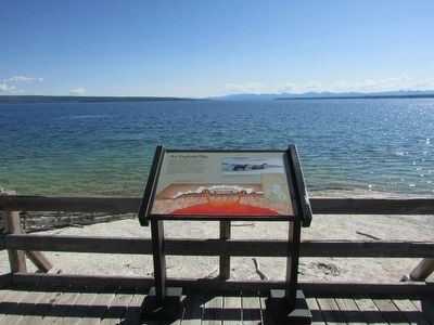
Location. 44° 24.996′ N, 110° 34.191′ W. Marker is in Yellowstone National Park, Wyoming, in Park County. It is in Mammoth. Marker can be reached from Grand Loop Road, on the left when traveling south. Marker is locate on a walking trail at West Thumb Geyser Basin. Touch for map. Marker is in this post office area: Yellowstone National Park WY 82190, United States of America. Touch for directions.
Other nearby markers. At least 6 other markers are within 16 miles of this marker, measured as the crow flies. Wilderness Architecture (approx. 13.9 miles away); Off the Hook (approx. 13.9 miles away); Cutthroat (approx. 13.9 miles away); Why is there no fishing from Fishing Bridge? (approx. 13.9 miles away); Black Dragonís Caldron (approx. 15.6 miles away); Leaping the Rapids (approx. 16 miles away).
More about this marker. An illustration at the bottom of the marker depicts magma erupting from the earthís crust. It has a caption of “This bay is a crater within a crater – a volcanic eruption and violent collapse within the larger, earlier Yellowstone caldera.” A map on the right side of the marker shows the locations of the West Thumb caldera and Mary Bay Crater within the Yellowstone caldera. A picture of river otters at a hole in the ice on Yellowstone Lake appears at the upper right of the marker.
Credits. This page was last revised on February 16, 2023. It was originally submitted on September 9, 2015, by Bill Coughlin of Woodland Park, New Jersey. This page has been viewed 376 times since then and 19 times this year. Photos: 1, 2, 3. submitted on September 9, 2015, by Bill Coughlin of Woodland Park, New Jersey.


