Fishers Hill in Shenandoah County, Virginia — The American South (Mid-Atlantic)
Fisher’s Hill
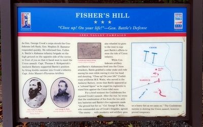
“Close up! On your life!”—Gen. Battle’s Defense
— 1864 Valley Campaign —
While Confederate artillery and Battle’s Alabamians fired into the Union attackers, Battle grabbed a cedar stake and rode among his men while waving it over his head and shouting, “Close up! On your life!” Confederate artillerist M.S. Watts, who served in the Amherst Battery, wrote that Battle appeared as a “colossal figure” as he urged his regiments to stand firm against the Union tidal wave.
For a brief moment the Confederate fire stymied Crook’s assault. After the war, he wrote that the combination of fire from the two artillery batteries and Battle’s five regiments made “the ground hot for us.” Col. George D. Wells, who commanded one of Crook’s brigades, agreed “The enemy … with musketry and artillery gave us a heavy fire as we came on.” The Confederate success in slowing the Union assault, however, proved temporary.
(captions)
Gen. Cullen A. Battle Courtesy U.S. Army Military History Institute
Col. George D. Wells Courtesy Jonathan A. Noyalus
Confederate battery firing Courtesy Library of Congress
Erected by Virginia Civil War Trails.
Topics and series. This historical marker is listed in this topic list: War, US Civil. In addition, it is included in the Virginia Civil War Trails series list. A significant historical date for this entry is September 22, 1864.
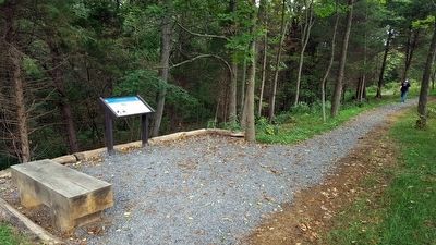
Location. 38° 59.31′ N, 78° 25.253′ W. Marker is in Fishers Hill, Virginia, in Shenandoah County. Marker can be reached from Battlefield Road (Virginia Route 601) 0.3 miles east of Tumbling Run Lane, on the left when traveling west. Located along the 1-mile loop trail on the Ramseur's Hill - Fisher's Hill Battlefield. Touch for map. Marker is at or near this postal address: 601 Battlefield Rd, Fishers Hill VA 22626, United States of America. Touch for directions.
Other nearby markers. At least 8 other markers are within walking distance of this marker. A different marker also named Fisher's Hill (within shouting distance of this marker); a different marker also named Fisher’s Hill (within shouting distance of this marker); a different marker also named Fisher’s Hill (about 300 feet away, measured in a direct line); a different marker also named Fisher’s Hill (about 500 feet away); a different marker also named Fisher’s Hill (about 600 feet away); a different marker also named Fisher’s Hill (about 700 feet away); a different marker also named Fisher’s Hill (approx. 0.2 miles away); Battle of Fisher’s Hill (approx. 0.2 miles away). Touch for a list and map of all markers in Fishers Hill.
Also see . . .
1. Battle of Fisher’s Hill. Shenandoah at War (Submitted on September 13, 2015.)
2. Fisher’s Hill. American Battlefield Trust (Submitted on September 13, 2015.)
Credits. This page was last revised on November 14, 2021. It was originally submitted on September 13, 2015, by Bernard Fisher of Richmond, Virginia. This page has been viewed 520 times since then and 31 times this year. Photos: 1, 2. submitted on September 13, 2015, by Bernard Fisher of Richmond, Virginia.

