Brutus in Cayuga County, New York — The American Northeast (Mid-Atlantic)
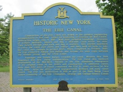
The Erie Canal
Historic New York
Passenger and freight barges crowded the canal. Western New York flourished with new, cheap transportation. The Erie Canal also hastened development of the Mid-West. Success of the Erie stimulated enlargement of the original canal in the 1840's and construction of additional canals. More than 500 miles of canals connected the Erie to other sections of New York State. After the 1870's, canal transportation declined and many canals closed. The Erie was modernized in 1918 as part of the State Barge Canal System consisting of the Erie, Champlain, Oswego and Cayuga-Seneca Canals.
Erected 1961 by New York State Education Department, New York State Department of Public Works .
Topics and series. This historical marker is listed in this topic list: Waterways & Vessels. In addition, it is included in the Erie Canal, and the Historic New York State series lists. A significant historical year for this entry is 1817.
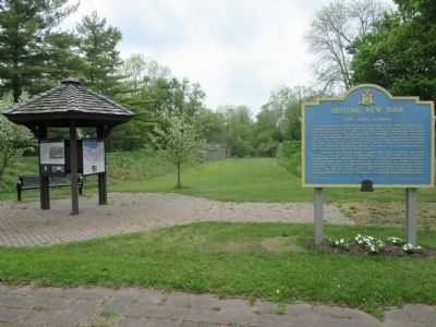
Location. 43° 2.59′ N, 76° 34.564′ W. Marker is in Brutus, New York, in Cayuga County. Marker is at the intersection of New York State Route 31 and West Brutus Street, on the right when traveling east on State Route 31. Marker is at a parking area parallel to NY Route 31 and across from West Brutus Street. Touch for map. Marker is in this post office area: Weedsport NY 13166, United States of America. Touch for directions.
Other nearby markers. At least 8 other markers are within walking distance of this marker. A different marker also named The Erie Canal (a few steps from this marker); The Boom Years (a few steps from this marker); Conduit For Ideas (a few steps from this marker); God's Acre (approx. 0.6 miles away); Weed's Basin (approx. ¾ mile away); Town of Brutus (approx. ¾ mile away); First Baptist Church of Weedsport (approx. ¾ mile away); Firehouse (approx. 0.8 miles away). Touch for a list and map of all markers in Brutus.
Credits. This page was last revised on June 16, 2016. It was originally submitted on May 23, 2015, by Anton Schwarzmueller of Wilson, New York. This page has been viewed 524 times since then and 19 times this year. Last updated on September 14, 2015, by Steve Masler of Memphis, Tennessee. Photos: 1, 2. submitted on May 23, 2015, by Anton Schwarzmueller of Wilson, New York. • Andrew Ruppenstein was the editor who published this page.

