Centreville in Fairfax County, Virginia — The American South (Mid-Atlantic)
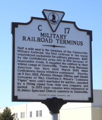
Military Railroad Terminus
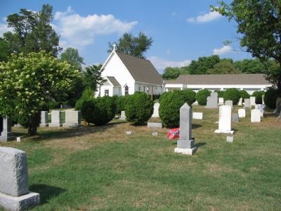
Nearby on 9 Dec. 1862, Privates Michael O’Brien and Dennis Corcoran of Maj. Chatham R. Wheat’s “Louisiana Tigers” were court-martialed for mutiny, executed by a firing squad from their own company, and buried. In 1979 their remains were reinterred at St. John’s Episcopal Church cemetery in Centreville.
Erected 1996 by the Department of Historic Resources. (Marker Number C-17.)
Topics and series. This historical marker is listed in these topic lists: Railroads & Streetcars • War, US Civil. In addition, it is included in the Virginia Department of Historic Resources (DHR) series list. A significant historical year for this entry is 1861.
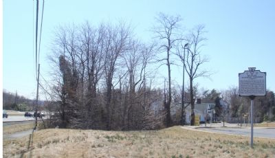
Location. 38° 49.533′ N, 77° 26.3′ W. Marker is in Centreville, Virginia, in Fairfax County. Marker is on Centreville Road (Virginia Route 28) south of New Braddock Road, on the right when traveling south. Old Centreville Road terminates just short of Centreville Road, without intersecting with it. The marker is where the intersection would be and can be seen from either road. Touch for map. Marker is at or near this postal address: 6315 St Timothys Ln, Centreville VA 20121, United States of America. Touch for directions.
Other nearby markers. At least 7 other markers are within one mile of this marker, measured as the crow flies. Mystery Of The Centreville Six (approx. ¾ mile away); Campaign of Second Manassas (approx. 0.9 miles away); Confederate Defenses (approx. 0.9 miles away); First Battle of Manassas (approx. 0.9 miles away); Second Battle of Manassas (approx. 0.9 miles away); Civil War Fortifications (approx. one mile away); Lane's Mill and Newton's Mill Ruins (approx. 1.1 miles away). Touch for a list and map of all markers in Centreville.
More about this marker. There is parking at the end of Old Centreville Road. To reach it continue south past marker to first right on Old Mill Road, then right on Old Centreville Road. Then turn right in order to stay on Old Centreville road.
Regarding Military Railroad Terminus. The Centreville Military Railroad was a branch line of the Orange and Alexandria Railroad. The portion of the line between Orange and Manassas, plus this extension to Centreville, was operated by the Confederacy during this time. This branch line was six miles long.
Also see . . .
1. Execution of Two Tigers. Letter written by Second Lieutenant Edward Hewitt on December 12, 1861. It was originally published in a New Orleans newspaper. (Submitted on March 12, 2007.)
2. Civil War Vignettes. Confederate Firing Squad at Centreville: First Military Executions in the Army. 1980 article by Michael R. Thomas with extensive first-person quotes. Also includes a short coda by the author entitled “Unearthing the Tiger’s Graves” regarding the 1979 exhumation and reburial of the two men. (Submitted on March 12, 2007.)
Credits. This page was last revised on July 7, 2021. It was originally submitted on March 12, 2007, by J. J. Prats of Powell, Ohio. This page has been viewed 3,185 times since then and 60 times this year. Photos: 1, 2. submitted on March 12, 2007, by J. J. Prats of Powell, Ohio. 3. submitted on September 2, 2007, by Craig Swain of Leesburg, Virginia.


