Near Fallon in Churchill County, Nevada — The American Mountains (Southwest)
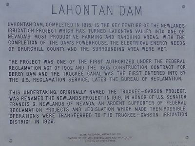
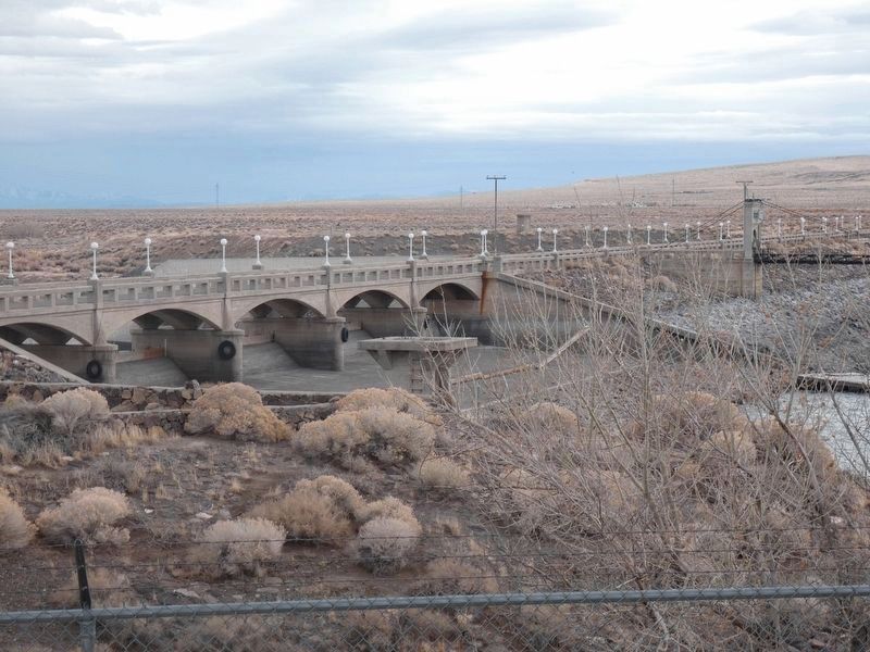
Lahontan Dam
The project was one of the first authorized under the Federal Reclamation Act of 1902 and the 1903 construction contract for Derby Dam and the Truckee Canal was the first entered into by the U.S. Reclamation Service, later the Bureau of Reclamation.
This undertaking, originally named the Truckee-Carson Project, was renamed the Newlands Project in 1919, in honor of U.S. Senator Francis G. Newlands of Nevada, an ardent supporter of federal reclamation projects and legislation which made them possible. Operations were transferred to the Truckee-Carson Irrigation District in 1926.
Erected by Division of Historic Preservation and Archeology. Division of State Parks. (Marker Number 215.)
Topics. This historical marker is listed in this topic list: Waterways & Vessels. A significant historical year for this entry is 1915.
Location. 39° 27.967′ N, 119° 4.165′ W. Marker is near Fallon, Nevada, in Churchill County. Marker can be reached from U.S. 50. This marker is on a road directly north of the dam, approximately 1/10th of a mile south of U.S. Highway 50. Touch for map. Marker is in this post office area: Fallon NV 89406, United States of America. Touch for directions.
Other nearby markers. At least 8 other markers are within 14 miles of this marker, measured as the crow flies. Williams Station (approx. 1.8 miles away); Carson Trail - Junction Wagon & Pack Routes (approx. 4.8 miles away); Hazen (approx. 6.8 miles away); Ragtown (approx. 8˝ miles away); Carson Trail - Ragtown (approx. 8.7 miles away); Stockton Well (approx. 12 miles away); America's First Transcontinental Highway (approx. 12.1 miles away); Rush to the River (approx. 13.2 miles away). Touch for a list and map of all markers in Fallon.
Credits. This page was last revised on March 16, 2021. It was originally submitted on October 10, 2015, by Trev Meed of Round Mountain, Nevada. This page has been viewed 499 times since then and 28 times this year. Photos: 1. submitted on October 10, 2015, by Trev Meed of Round Mountain, Nevada. 2, 3. submitted on October 11, 2015, by Trev Meed of Round Mountain, Nevada. 4. submitted on December 19, 2019, by Paulette Nelson of N Las Vegas, Nevada. • Syd Whittle was the editor who published this page.
Editor’s want-list for this marker. Wide area view of the marker and its surroundings. • Can you help?


