Near Sinclair in Carbon County, Wyoming — The American West (Mountains)
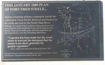
This January 1880 plan of Fort Fred Steele...
Inscription.
depicts a bustling military community astride the continental Union Pacific Railroad and flanked on the north and east by the Platte River.
Although the variety flora is limited, bitter cottonwood trees grown profusely with a smattering of pine and fir along the river bottom. Gramma and needle grass, artemisia (sagebrush) and salt-week sparsely cover the surrounding alkaline plains.
"A garden has been made but the result seems to warrant the statement that the season is too short, generally for garden vegetables." - Marcy, "Outline Description: Post & Stations of Troops," 1872.
Erected by Wyoming Recreation Commission.
Topics. This historical marker is listed in these topic lists: Agriculture • Forts and Castles • Horticulture & Forestry. A significant historical month for this entry is January 1880.
Location. 41° 46.702′ N, 106° 56.871′ W. Marker is near Sinclair, Wyoming, in Carbon County. Marker is on County Route 347 near Interstate 80. Touch for map. Marker is in this post office area: Sinclair WY 82334, United States of America. Touch for directions.
Other nearby markers. At least 8 other markers are within walking distance of this marker. The Great Lincoln Highway... (here, next to this marker); Wild Times In Benton! (here, next to this marker); The Passenger's Railroad (here, next to this marker); Officer's Quarters (within shouting distance of this marker); Officers Who Commanded Fort Fred Steele (within shouting distance of this marker); Fort Steele Schoolhouse (within shouting distance of this marker); Fort Fred Steele (within shouting distance of this marker); Enlisted Men's Barracks (within shouting distance of this marker). Touch for a list and map of all markers in Sinclair.
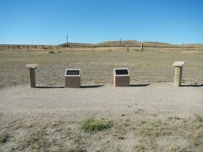
More about this marker. This marker, among a grouping of a four other markers, is located at Fort Fred Steele State Historic Site. The site is on County Road 347, north of the Interstate 80 Exit 228 and on the north side of the railroad tracks.
Credits. This page was last revised on June 16, 2016. It was originally submitted on October 24, 2015, by Barry Swackhamer of Brentwood, California. This page has been viewed 313 times since then and 11 times this year. Photos: 1, 2, 3. submitted on October 24, 2015, by Barry Swackhamer of Brentwood, California.


