Near Evanston in Uinta County, Wyoming — The American West (Mountains)
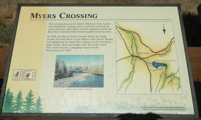
Myers Crossing
In 1858, the Myers Ranch, located where the bridge cross the Bear River on the Mirror Lake Scenic Byway, was designated the Bear River Station on the Overland Stage Route. Mail and freight were left at the ranch. This ranch became a changing station for the Pony Express in 1861.
Erected by Timeless Tracks, Incorporated; City of Evanston, Wyoming; United States Forest Service; Federal Highway Administration, U.S. Department of Transportation; State of Wyoming, Department of Transportation; Interpretive Graphics; At Home Services.
Topics and series. This historical marker is listed in this topic list: Roads & Vehicles. In addition, it is included in the Mormon Pioneer Trail series list.
Location. 41° 9.474′ N, 110° 51.056′ W. Marker is near Evanston, Wyoming, in Uinta County. Marker is on State Highway 150 near County Route 75, on the left when traveling south. Touch for map. Marker is at or near this postal address: 9998 Wyoming Highway 150, Evanston WY 82930, United States of America. Touch for directions.
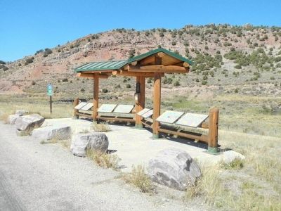
Other nearby markers. At least 8 other markers are within 2 miles of this marker , measured as the crow flies. Native Americans (here, next to this marker); Historic Trails (here, next to this marker); Transcontinental Railroad (a few steps from this marker); Aspen Tunnel (a few steps from this marker); Bear River City (a few steps from this marker); Mormon Trail (approx. 1.1 miles away); Hilliard City and Piedmont (approx. 1.3 miles away); Hilliard, Wyoming (approx. 1.4 miles away). Touch for a list and map of all markers in Evanston.
Credits. This page was last revised on January 31, 2021. It was originally submitted on October 31, 2015, by Barry Swackhamer of Brentwood, California. This page has been viewed 775 times since then and 52 times this year. Last updated on January 31, 2021, by Clay Myers of Evanston, Wyoming. Photos: 1, 2. submitted on October 31, 2015, by Barry Swackhamer of Brentwood, California.

