Near Rogers in Benton County, Arkansas — The American South (West South Central)
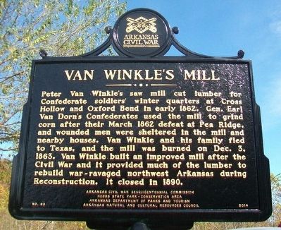
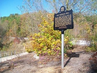
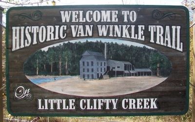
Van Winkle's Mill
Erected 2014 by Arkansas Civil War Sesquicentennial Commission; Hobbs State Park—Conservation Area; Arkansas Department of Parks and Tourism; Arkansas Natural and Cultural Resources Council. (Marker Number 83.)
Topics and series. This historical marker is listed in these topic lists: Industry & Commerce • Settlements & Settlers • War, US Civil. In addition, it is included in the Arkansas Civil War Sesquicentennial Commission series list. A significant historical month for this entry is March 1862.
Location. 36° 17.811′ N, 93° 57.503′ W. Marker is near Rogers, Arkansas, in Benton County. Marker is on State Highway 12, 0.1 miles west of Van Winkle Place Road, on the left when traveling west . Touch for map. Marker is at or near this postal address: Hobbs State Park - Conservation Area Parking Area, Rogers AR 72756, United States of America. Touch for directions.
Other nearby markers. At least 8 other markers are within 10 miles of this marker, measured as the crow flies. War Eagle Mills Farm (approx. 2.2 miles away); War Eagle Mills (approx. 2.2 miles away); War Eagle Mill (approx. 2.2 miles away); Cross Hollows (approx. 8.7 miles away); a different marker also named Cross Hollows (approx. 8.7 miles away); The Butterfield Overland Mail In Arkansas (approx. 9.1 miles away); Applegate Drugstore (approx. 9.1 miles away); Bank of Rogers (approx. 9.1 miles away). Touch for a list and map of all markers in Rogers.
Credits. This page was last revised on August 16, 2020. It was originally submitted on November 18, 2015, by William Fischer, Jr. of Scranton, Pennsylvania. This page has been viewed 602 times since then and 55 times this year. Photos: 1, 2, 3. submitted on November 18, 2015, by William Fischer, Jr. of Scranton, Pennsylvania.


