Near Pound in Wise County, Virginia — The American South (Mid-Atlantic)
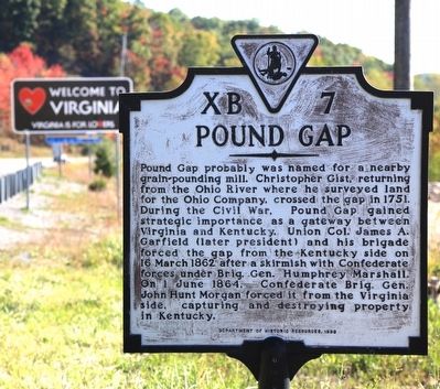
Pound Gap
Erected 1999 by Department of Historic Resources. (Marker Number XB-7.)
Topics and series. This historical marker is listed in these topic lists: Settlements & Settlers • War, US Civil. In addition, it is included in the Virginia Department of Historic Resources (DHR) series list. A significant historical year for this entry is 1751.
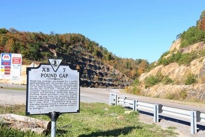
Location. 37° 9.289′ N, 82° 37.838′ W. Marker is near Pound, Virginia, in Wise County. Marker is on Orby Cantrell Highway (U.S. 23), on the right when traveling south. It is just inside the state line at the gas station. Touch for map. Marker is in this post office area: Pound VA 24279, United States of America. Touch for directions.
Other nearby markers. At least 8 other markers are within walking distance of this marker . Leonard Woods Lynched (a few steps from this marker); Wise County / Kentucky (about 500 feet away, measured in a direct line); Caudill’s Army (approx. 0.2 miles away in Kentucky); Brothers Once More (approx. 0.2 miles away in Kentucky); Pound Gap Massacre (approx. 0.2 miles away in Kentucky); Pound Gap Engagement (approx. 0.4 miles away); a different marker also named Pound Gap (approx. 0.4 miles away in Kentucky); The Crooked Road (approx. 0.4 miles away).
More about this marker. This marker replaces one erected between 1937 and 1941 with the same title and number which read, “Christopher Gist, returning from the Ohio River, crossed this gap in 1751. James A. Garfield (afterwards President) with Union troops forced this gap in March, 1862. In June, 1864, John H. Morgan, on his Kentucky raid, forced it from the Virginia side, capturing and destroying much property.”
That marker replaced an earlier one with the same title and number from the late 1920s that read “Christopher Gist, returning from his Ohio explorations, crossed this gap in the spring of 1751. Moving southward, he camped at Gist’s station now Coeburn.”
Credits. This page was last revised on June 16, 2016. It was originally submitted on November 20, 2015, by J. J. Prats of Powell, Ohio. This page has been viewed 696 times since then and 47 times this year. Photos: 1, 2. submitted on November 20, 2015, by J. J. Prats of Powell, Ohio.

