Near Montpelier in Bear Lake County, Idaho — The American West (Mountains)
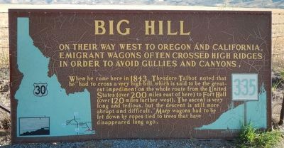
Big Hill
When he came here in 1843, Theodore Talbot noted that he "had to cross a very high hill, which is said to be the greatest impediment on the whole route from the United States (over 200 miles east of here) to Fort Hall (over 120 miles farther west). The ascent is very long and tedious, but the descent is still more abrupt and difficult." Many wagons had to be let down by ropes tied to trees that disappeared long ago.
Erected by Idaho Historical Society and Idaho Transportation Department. (Marker Number 335.)
Topics and series. This historical marker is listed in these topic lists: Roads & Vehicles • Settlements & Settlers. In addition, it is included in the Idaho State Historical Society, and the Oregon Trail series lists.
Location. 42° 14.158′ N, 111° 13.985′ W. Marker is near Montpelier, Idaho, in Bear Lake County. Marker is on U.S. 30 at milepost 441.7 near Hunters Lane, on the right when traveling west. Touch for map. Marker is in this post office area: Montpelier ID 83254, United States of America. Touch for directions.
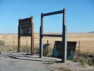
Other nearby markers. At least 8 other markers are within 2 miles of this marker, measured as the crow flies. The McAuley Cutoff (here, next to this marker); McAuley's Road (here, next to this marker); Big Hill... (a few steps from this marker); Hot, Cold, Dry, Wet, Dusty, 2,000-Mile Trail (a few steps from this marker); Idaho's Emigrant Trails (a few steps from this marker); a different marker also named Big Hill (a few steps from this marker); One Continual Stream (a few steps from this marker); Smith's Trading Post (approx. 1.6 miles away). Touch for a list and map of all markers in Montpelier.
Credits. This page was last revised on June 16, 2016. It was originally submitted on November 21, 2015, by Barry Swackhamer of Brentwood, California. This page has been viewed 802 times since then and 57 times this year. Photos: 1, 2. submitted on November 21, 2015, by Barry Swackhamer of Brentwood, California.

