Near Montpelier in Bear Lake County, Idaho — The American West (Mountains)
Big Hill

Photographed By Barry Swackhamer, September 11, 2015
1. Big Hill... Marker
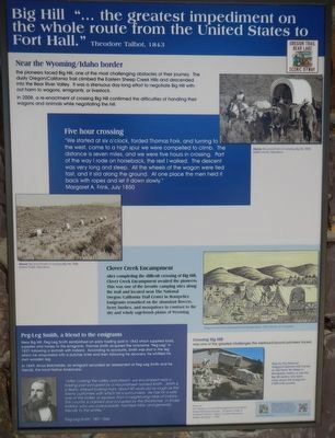
Captions: (top right) Re-enactment of crossing Big Hill, 2008; (center left) Re-enactment of crossing Big Hill, 2008; (center right) Wagons and Tents Encamped by Daniel Jenks, 1859; (bottom left) Peg-Leg Smith, 1806-1866; (bottom right) Crossing Big Hill was one of the greatest challenges the westward-bound pioneers faced. Stop by The National Oregon/California Trail Center at 320 North 4th Street in Montpelier, Idaho to see the Big Hill replica and lear more about the emigrants 2,000 mile journey.
Near the Wyoming/Idaho border the pioneers face Big Hill, on of the most challenging obstacles of their journey. The dusty Oregon/California Trail climbed the Eastern Sheep Creek Hills and descended into the Bear River Valley. It was a strenuous day-long effort to negotiate Big Hill without harm to wagons, emigrants, or livestock.
Five hour crossing
"We started at six o'clock, forded Thomas Fork, and turning to the west, came to a high spur we were compelled to climb. The distance is seven miles, and we were five hours in crossing. Part of the way I rode on horseback, the rest I walked. The descent was very long and steep. All the wheels of the wagon were tied fast, and it slid along the ground. At one place the men held it back with ropes and let it down slowly." -- Margaret A. Frink, July 1850
Clover Creek Encampment
After completing the difficult crossing of Big Hill, Clover Creek Encampment awaited the pioneers. This was one of the favorite camping sites along the trail and located near The National Oregon/California Trail Center in Montpelier. Emigrants remarked on the abundant flowers, berry bushes, and mosquitoes in contrast to the dry and wind sagebrush plains of Wyoming.
Peg-Leg Smith, a friend to the emigrants
Near Big Hill, Peg-Leg Smith established an early trading post in 1842 which supplied food, supplies and horses to the emigrants. Thomas Smith acquired the nickname "Peg-Leg' in 1827 following a skirmish with Indians. According to accounts, Smith was shot in the leg which he amputated with a butcher knife and then following his recovery, he whittled his own wooden leg.
In 1849, Amos Batchelder, an emigrant recorded an assessment of Peg-Leg Smith and his friends, the local Native Americans:
"After crossing the valley and stream, we encamped near a trading post occupied by a mountaineer named Smith... Smith is a fleshy, shrewd looking man, about 50 years old and as rough as the tawny customers with which he is surrounded. He has for a wife one of the ladies, or squaws, from a neighboring tribe of Indians, This country is claimed and occupied by the Shoshones, or Snake Indians, who are a peaceable, harmless tribe, and generally friendly to the whites."
Erected by The National Oregon/California Trail Center.
Topics and series. This historical marker is listed in these topic lists: Roads & Vehicles • Settlements & Settlers. In addition, it is included in the Oregon Trail series list.
Location.
42° 14.149′ N, 111° 13.978′ W. Marker is near Montpelier, Idaho, in Bear Lake County. Marker is on U.S. 30 at milepost 441.7 near Hunters Lane, on the right when traveling west. Touch for map. Marker is in this post office area: Montpelier ID 83254, United States of America. Touch for directions.
Other nearby markers. At least 8 other markers are within 2 miles of this marker, measured as the crow flies. Hot, Cold, Dry, Wet, Dusty, 2,000-Mile Trail (here, next to this marker); One Continual Stream (here, next to this marker); Big Hill... (here, next to this marker); Idaho's Emigrant Trails (here, next to this marker); a different marker also named Big Hill (a few steps from this marker); The McAuley Cutoff (a few steps from this marker); McAuley's Road (within shouting distance of this marker); Smith's Trading Post (approx. 1.7 miles away). Touch for a list and map of all markers in Montpelier.
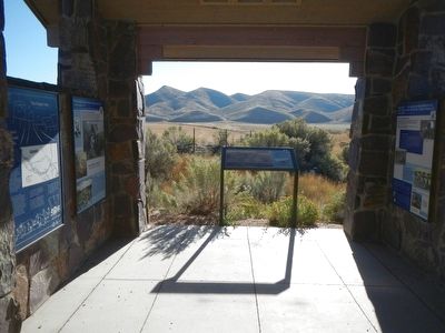
More about this marker. This marker is located in the stone kiosk.
Credits. This page was last revised on June 16, 2016. It was originally submitted on November 22, 2015, by Barry Swackhamer of Brentwood, California. This page has been viewed 1,171 times since then and 93 times this year. Photos: 1, 2. submitted on November 22, 2015, by Barry Swackhamer of Brentwood, California.
