Gate City in Scott County, Virginia — The American South (Mid-Atlantic)
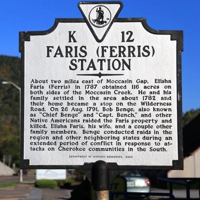
Faris (Ferris) Station
Erected 2004 by Department of Historic Resources. (Marker Number K-12.)
Topics and series. This historical marker is listed in these topic lists: Settlements & Settlers • Wars, US Indian. In addition, it is included in the Virginia Department of Historic Resources (DHR) series list. A significant historical year for this entry is 1782.
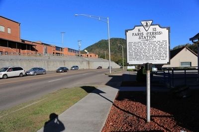
Location. 36° 38.313′ N, 82° 34.216′ W. Marker is in Gate City, Virginia, in Scott County. Marker is on Kane Street (Business U.S. 58) east of Jones Street, on the left when traveling west. Touch for map. Marker is at or near this postal address: 295 Kane St, Gate City VA 24251, United States of America. Touch for directions.
Other nearby markers. At least 8 other markers are within walking distance of this marker. Gate City (about 300 feet away, measured in a direct line); Blackmore’s Fort (about 400 feet away); Donelson's Indian Line (approx. half a mile away); Prospect Public School (approx. half a mile away); First Court of Scott County (approx. half a mile away); Moccasin Gap (approx. half a mile away); John P. McConnell (approx. half a mile away); Carter Musical Family (approx. half a mile away). Touch for a list and map of all markers in Gate City.
More about this marker. A 1931 marker with this number but simply titled “Faris Station” stood at the intersection of Kane and Jackson Streets in Gate City until at least 1994. It read “Near by stood the home and tavern of Elisha Faris, an early station on the Boone trail to Kentucky. Indians led by Chief Benge here massacred members of the Faris family in 1791.”
Credits. This page was last revised on October 12, 2023. It was originally submitted on November 25, 2015, by J. J. Prats of Powell, Ohio. This page has been viewed 794 times since then and 86 times this year. Photos: 1, 2. submitted on November 25, 2015, by J. J. Prats of Powell, Ohio.

