Near Cody in Park County, Wyoming — The American West (Mountains)
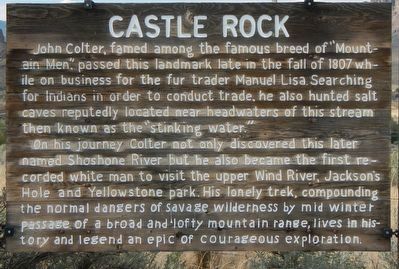
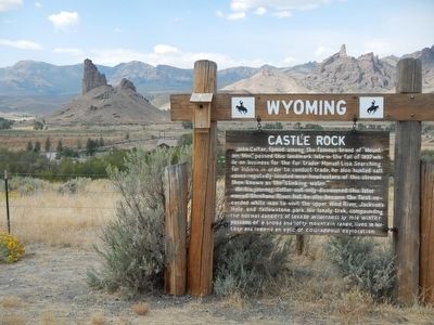
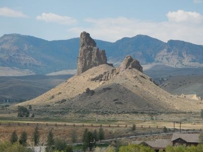
Castle Rock
On his journey Colter not only discovered this later named Shoshone River but became the first recorded white man to visit the upper Wind River, Jackson's Hole and Yellowstone park. His lonely trek, compounding the normal dangers of savage wilderness by mid winter passage of a broad and lofty mountain range, lives in history and legend an epic of courageous exploration
Erected by Wyoming State Parks & Cultural Resources.
Topics. This historical marker is listed in this topic list: Natural Features.
Location. 44° 22.89′ N, 109° 18.312′ W. Marker is near Cody, Wyoming, in Park County. Marker is on Southfork Road (State Highway 291) near Davis Draw Road, on the right when traveling south. Touch for map. Marker is at or near this postal address: 1674 Southfork Road, Cody WY 82414, United States of America. Touch for directions.
Other nearby markers. At least 8 other markers are within 13 miles of this marker, measured as the crow flies. Buffalo Bill Reservoir (approx. 9.2 miles away); Absaroka Volcanic Field (approx. 9˝ miles away); Upstream Cableway Winch (approx. 10.1 miles away); Balanced Plunger Hydraulic Valve (approx. 10.1 miles away); Ball Plug (approx. 10.1 miles away); Buffalo Bill Dam (approx. 10.3 miles away); Shoshone Canyon (approx. 12.1 miles away); Shoshone River Siphon (approx. 12.7 miles away). Touch for a list and map of all markers in Cody.
More about this marker. This marker is about 17 miles southwest of Cody of Southfork Road.
Credits. This page was last revised on June 16, 2016. It was originally submitted on November 27, 2015, by Barry Swackhamer of Brentwood, California. This page has been viewed 947 times since then and 63 times this year. Photos: 1, 2, 3. submitted on November 27, 2015, by Barry Swackhamer of Brentwood, California.


