Berlin in Worcester County, Maryland — The American Northeast (Mid-Atlantic)
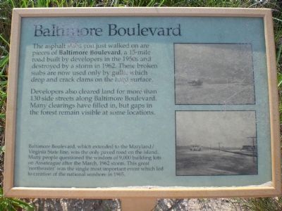
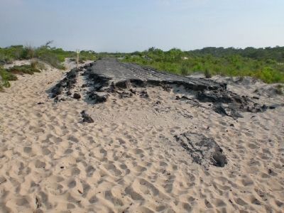
Baltimore Boulevard
Developers also cleared land for more than 130 side streets along Baltimore Boulevard. many clearings have filled in, but gaps in the forest remain visible in some locations.
Baltimore Boulevard, which extended to the Maryland/ Virginia State line, was the only paved road on the island. Many people questioned the wisdom of 9,000 building lots on Assateague after the March 1962 storm. This great 'northeaster' was the single most important event which led to creation of the national seashore in 1965.
Erected by National Park Service, U.S. Department of the Interior.
Topics. This historical marker is listed in these topic lists: Animals • Disasters • Roads & Vehicles. A significant historical month for this entry is March 1962.
Location. 38° 11.345′ N, 75° 9.603′ W. Marker is in Berlin, Maryland, in Worcester County. Marker can be reached from Bayberry Drive (Route 611) 1.1 miles Bayside Drive. Marker is on Life of the Dunes Nature Trail, about a sixth of a mile from the parking lot at the south end of Bayberry Drive. Touch for map. Marker is in this post office area: Berlin MD 21811, United States of America. Touch for directions.
Other nearby markers. At least 8 other markers are within 4 miles of this marker, measured as the crow flies. Keep Them Safe / Keep Them Wild (about 600 feet away, measured in a direct line); Native Americans (approx. 0.7 miles away); Saving Lives (approx. 0.7 miles away); Olde Sinepuxent (approx. 0.8 miles away); a different marker also named Keep Them Safe / Keep Them Wild (approx. 1.2 miles away); Wild and Free (approx. 3˝ miles away); Swindler Park (approx. 3˝ miles away); Peregrine Falcon Migration (approx. 3˝ miles away). Touch for a list and map of all markers in Berlin.
Also see . . . Assateague Island National Seashore Weather. Describes the effects of the 1962 storm. (Submitted on July 13, 2008, by Linda Walcroft of Woodstock, Virginia.)
Credits. This page was last revised on January 12, 2020. It was originally submitted on July 13, 2008, by Linda Walcroft of Woodstock, Virginia. This page has been viewed 2,837 times since then and 250 times this year. Photos: 1, 2. submitted on July 13, 2008, by Linda Walcroft of Woodstock, Virginia. • Christopher Busta-Peck was the editor who published this page.

