Savannah in Chatham County, Georgia — The American South (South Atlantic)
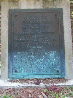
Beaulieu Plantation
to
William Stephens
Secretary
Colony of Georgia
1737 - 1740
President
1743 - 1751
Here in 1779 under
Count d'Estaing the
French landed to join
the Americans under
General Lincoln in
the Siege Of Savannah
W.P.A. 1936. D.A.R. S.R.
Erected 1936 by The W.P.A. D.A.R. S.R.
Topics and series. This historical marker is listed in these topic lists: Colonial Era • Landmarks • Notable Places • Settlements & Settlers • War, US Revolutionary. In addition, it is included in the Daughters of the American Revolution, and the Works Progress Administration (WPA) projects series lists. A significant historical year for this entry is 1739.
Location. 31° 56.064′ N, 81° 6.719′ W. Marker is in Savannah, Georgia, in Chatham County. Marker is on Beaulieu Avenue near Butler Street. The plantation is not open to the public. Touch for map. Marker is in this post office area: Savannah GA 31406, United States of America. Touch for directions.
Other nearby markers. At least 8 other markers are within 3 miles of this marker, measured as the crow flies. Site of Colonial Shipyard (approx. 0.6 miles away); Pin Point Community (approx. 1˝ miles away); White Bluff • Coffee Bluff (approx. 1.6 miles away); Brick Pillar (approx. 2 miles away); Bethesda (approx. 2 miles away); Nicholsonboro (approx. 2.3 miles away); Capture of the USS "Water Witch" (approx. 2.4 miles away); Vernonburg (approx. 2.4 miles away). Touch for a list and map of all markers in Savannah.
Regarding Beaulieu Plantation. The Battle of the Siege of Savannah
Vice-Admiral Charles-Henri d'Estaing had sailed from San Domingo in the West Indies in August; his French troops had been disembarked in September at Beaulieu Plantation on the Vernon River, fourteen miles south of Savannah, and at Bonaventure and Greenwich Plantations on St. Augustine Creek near Thunderbolt, three and one-half miles east of Savannah. When the invading French, who had been joined by American militia, formed a half-circle around the British Savannah on September 15, the French-American forces numbered about 5500. Within the city, the British forces were approximately 2630 of which 200 were armed Negros and 80 Creek and Cherokee Indians. When the battle ended at Spring Hill that October 9th morning, 333 British, French and American soldiers and 32 officers were dead; 377 lay wounded. The British had lost only three officers and fifteen soldiers. The dead were buried in a mass grave probably on the site of the present Savannah visitor's Center.
from The Siege of Savannah [http://www.geocities.com/sou1belle/Siege1.htm]

Photographed By Mike Stroud, 2008
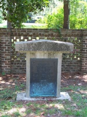
3. Beaulieu Plantation Marker
Beaulieu Plantation:
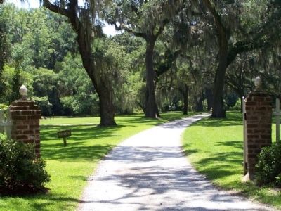
This tree-lined drive marks the entrance to Beaulieu Plantation, the estate of William Stephens, who came to Savannah in 1737 to serve as secretary of Trustee Georgia. Beaulieu was one of the leading river plantations, and Stephens experimented with grape and cotton cultivation.
Credits. This page was last revised on March 27, 2020. It was originally submitted on July 14, 2008, by Mike Stroud of Bluffton, South Carolina. This page has been viewed 14,518 times since then and 1,327 times this year. Photos: 1, 2, 3. submitted on July 14, 2008, by Mike Stroud of Bluffton, South Carolina. • Christopher Busta-Peck was the editor who published this page.

