Near Buffalo in Johnson County, Wyoming — The American West (Mountains)
TA Ranch
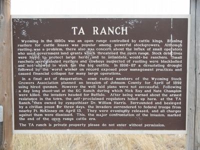
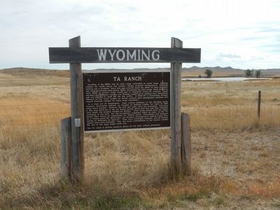
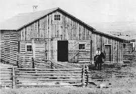
In a final act of desperation, some radical members of the Wyoming Stock Growers Association planned an invasion of Johnson County for April of 1892 using hired gunmen. However the well laid plans were not successful. Following a day long shoot-out at the KC Ranch during which Nick Ray and Nate Champion were killed, the invaders headed for Buffalo. After being warned about the armed resistance in town, the self-proclaimed regulators holed up here, at the TA Ranch, then owned by sympathizer Dr. William Harris. Surrounded and besieged by a civilian posse for three days, the invaders surrendered to federal troops from nearby Ft. McKinney on April 13. They were eventually released, and all charges against them dismissed. This, the major confrontation of the invasion, marked the end of the open range cattle era.
The TA ranch is private property please do not enter without permission.
Erected by Wyoming State Parks & Cultural Resources.
Topics. This historical marker is listed in this topic list: Notable Events. A significant historical date for this entry is March 13, 1892.
Location. 44° 9.312′ N, 106° 42.084′ W. Marker is near Buffalo, Wyoming, in Johnson County. Marker is at the intersection of Old Highway 87 (State Highway 196 at milepost 287) and T A Ranch Road, on the right when traveling north on Old Highway 87. Touch for map. Marker is at or near this postal address: 28599 Old Highway 87, Buffalo WY 82834, United States of America. Touch for directions.
Other nearby markers. At least 8 other markers are within 13 miles of this marker, measured as the crow flies. Tisdale Divide (approx. 5.7 miles away); The Legend of Crazy Woman (approx. 10.1 miles away); Conflict at the Crossing (approx. 10.1 miles away); Bozeman's Trail: (approx. 10.1 miles away); Lieut. N.P. Daniels, U.S.A. (approx. 10.1 miles away); Veteran's Home of Wyoming War Memorials (approx. 12.4 miles away); Fort McKinney (approx. 12.9 miles away); Greenbelt Trail–Klondike Access (approx. 13 miles away). Touch for a list and map of all markers in Buffalo.
Also see . . . TA Ranch Historic District - Wikipedia. ...the mercenary company was resented by the smaller landowners prevalent in northern Wyoming and were confronted by a large group of local settlers and cowboys. The gunmen (frequently referred to as "invaders") retreated to the TA Ranch, which they proceeded to fortify. Soon, about fifty invaders were surrounded by almost four hundred locals. The invaders were rescued by U.S. Cavalry from Fort McKinney on the third day of the siege. (Submitted on December 14, 2015, by Barry Swackhamer of Brentwood, California.)
Additional keywords. Johnson County War
Credits. This page was last revised on June 16, 2016. It was originally submitted on December 14, 2015, by Barry Swackhamer of Brentwood, California. This page has been viewed 532 times since then and 30 times this year. Photos: 1, 2, 3. submitted on December 14, 2015, by Barry Swackhamer of Brentwood, California.


