Near Crockett in Contra Costa County, California — The American West (Pacific Coastal)
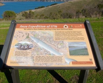
Anza Expedition of 1776
"We called to these Indians, hoping to buy their fish from them."
From Father Pedro Font's Diary, April 2, 1776
In 1775 and 1776, Lt. Colonel Juan Bautista de Anza, Father Pedro Font, along with 240 settlers, soldiers, and others traveled 1,800 miles from Sonora, Mexico to Monterey, California. Anza then led a smaller party to choose sites for the mission and presidio (military base) in San Francisco, and to explore the East Bay.
On April 2, 1776, the explorers stopped near this location and traded for a fish they had never seen before from local fishermen, perhaps from a nearby Carquin Ohlone village.
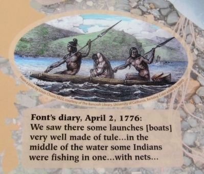
Font's Diary, April 2, 1776: We saw there some launches [boats] very well made with tule...in the middle of the waterside Indians were fishing in one...with nets...
Anza's Diary, April 2, 1776: [They traded]...us a fish two and one-eighth varas * long ...entirely lacking in scales or interior bones...between the skin and the flesh there were some very perfect stars painted on the skull...Their eyes were gilded but very small...we ate it and found it very palatable and tender...
[* 1 vara = 2.7 feet. The fish was a sturgeon over 6 feet long.]
Welcome to the homeland of the Huichun-Aguasto, and Ohlone-speaking tribe.
Dates and stories taken from the diaries of Anza and Font, courtesy of the Center for Advanced Technology in Education, University of Oregon, www.anza.uoregon.edu
Erected by East Bay Regional Parks District, National Parks Service.
Topics and series. This historical marker is listed in these topic lists: Exploration • Native Americans. In addition, it is included in the Juan Bautista de Anza National Historic Trail series list. A significant historical date for this entry is April 2, 1776.
Location. 38° 2.995′ N, 122° 11.796′ W. Marker is near Crockett, California, in Contra Costa County. Marker can be reached from Carquinez Scenic Drive, 0.7 miles east of Winslow Street. Touch for map. Marker is in this post office area: Crockett CA 94525, United States of America. Touch for directions.
Other nearby markers. At least 8 other markers are within 2 miles of this marker, measured as the crow flies. Crockett World War I Veterans Memorial (approx. ¾ mile away); The Burlington Hotel (approx. ¾ mile away); McNear Warehouse (approx. ¾ mile away); Turner / Robertson Shipyard (approx. 1.3 miles away); Commodore Jones Point (approx. 1.3 miles away); Remnants from Days Gone By (approx. 1.3 miles away); A Retreat in the Hills (approx. 1.4 miles away); The Old Homestead (approx. 1.4 miles away). Touch for a list and map of all markers in Crockett.
More about this marker. This marker
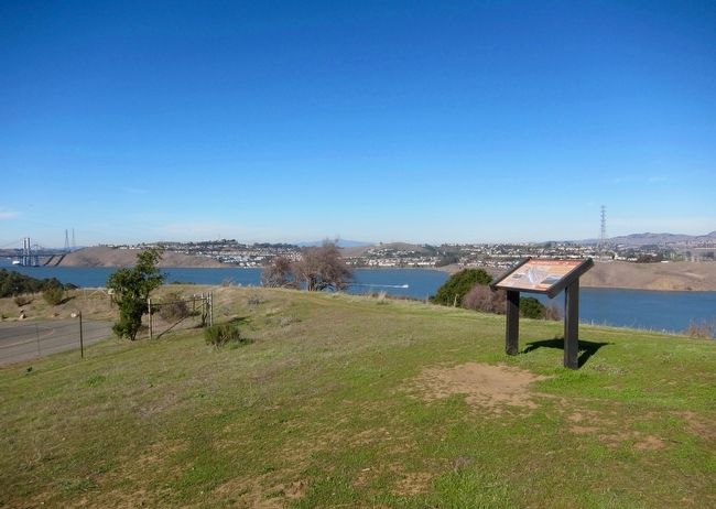
is in the Carquinez Strait Regional Shoreline Park, about halfway between Crockett and Port Costa. When driving along the Carquinez Scenic Drive from either town, on the straits-ward side of the road there will be a signed entrance. Park in the parking lot, and walk through the gate at the trailhead - the marker will be easily visible a couple of hundred feet due north.
Also see . . . Juan Bautista de Anza National Historic Trail - Arizona and California. The National Park Service overview of the expedition and trail. (Submitted on December 17, 2015, by Andrew Ruppenstein of Lamorinda, California.)
Credits. This page was last revised on June 16, 2016. It was originally submitted on December 17, 2015, by Andrew Ruppenstein of Lamorinda, California. This page has been viewed 454 times since then and 19 times this year. Photos: 1, 2, 3. submitted on December 17, 2015, by Andrew Ruppenstein of Lamorinda, California.


