Casper in Natrona County, Wyoming — The American West (Mountains)
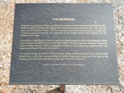
The Mormons
In October of 1856 Natrona County’s greatest tragedy began at what is now Bessemer Bend and continued to Martin’s cove near Devil’s Gate. The sixth Mormon Handcart Company, under Captain Edward Martin, struggled through an early Wyoming blizzard. Over 135 persons perished in this 50 mile stretch.
Of handcart travel, Chislett’s narrative states, “Many a father pulled his cart, with his little children on it, until the day preceding his death. I have seen some pull their carts in the morning, give out during the day, and die before the next morning.”
Erected by Natrona County Historical Society.
Topics. This historical marker is listed in these topic lists: Roads & Vehicles • Settlements & Settlers.
Location. 42° 50.173′ N, 106° 22.316′ W. Marker is in Casper, Wyoming, in Natrona County. Marker can be reached from Fort Caspar Road, 0.1 miles west of Wyoming Route 258, on the right when traveling west. Touch for map. Marker is at or near this postal address: 4001 Fort Caspar Road, Casper WY 82604, United States of America. Touch for directions.
Other nearby markers. At least 8 other markers are within walking distance of this marker. Richard Bridge and Military Complex (here, next to this marker); Oregon/California/Mormon Trails (here, next to this marker); Military Explorers (here, next to this marker); Pony Express (here, next to this marker); Bridger and Bozeman Trails (a few steps from this marker); Robert Stuart Cabin Site (a few steps from this marker); Ranching in Wyoming (a few steps from this marker); Indians Of Wyoming (a few steps from this marker). Touch for a list and map of all markers in Casper.
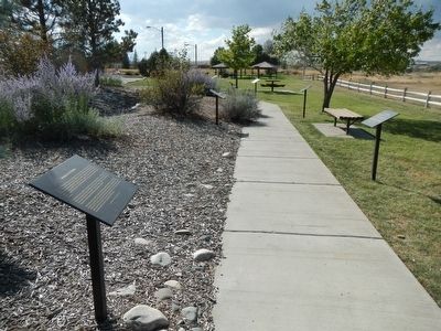
More about this marker. This marker is part of the Wyoming history walk in Centennial Park, which is adjacent to the Fort Caspar Museum and shares the parking lot.
Credits. This page was last revised on January 12, 2021. It was originally submitted on December 19, 2015, by Barry Swackhamer of Brentwood, California. This page has been viewed 391 times since then and 11 times this year. Last updated on January 12, 2021, by Craig Baker of Sylmar, California. Photos: 1, 2. submitted on December 19, 2015, by Barry Swackhamer of Brentwood, California. • J. Makali Bruton was the editor who published this page.

