Casper in Natrona County, Wyoming — The American West (Mountains)
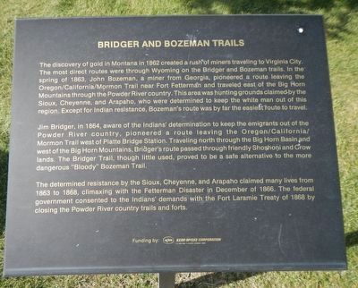
Bridger and Bozeman Trails
Jim Bridger, in 1864, aware of the Indians’ determination to keep the emigrants out of the Powder River country, pioneered a route leaving the Oregon/California/Mormon Trail west of Platte Bridge Station. Traveling north through the Big Horn Basin and west of the Big Horn Mountains, Bridger’s route passed through friendly Shoshoni and Crow lands The Bridger Trail, though little used, proved to be a safe alternative to the more dangerous “Bloody” Bozeman Trail.
The determined resistance by the Sioux, Cheyenne, and Arapaho claimed many lives from 1863 to 1868, climaxing with the Fetterman Disaster in December of 1866. The federal government consented to the Indians’ demands with the Fort Laramie Treaty of 1868 by closing the Powder River country trails and forts.
Erected by Natrona County Historical Society.
Topics. This historical marker is listed in this topic list: Roads & Vehicles.
Location. 42° 50.172′ N, 106° 22.324′ W. Marker is in Casper, Wyoming, in Natrona County. Marker can be reached from Fort Caspar Road, 0.1 miles west of Wyoming Route 258, on the right when traveling west. Touch for map. Marker is at or near this postal address: 4001 Fort Caspar Road, Casper WY 82604, United States of America. Touch for directions.
Other nearby markers. At least 8 other markers are within walking distance of this marker. Ranching in Wyoming (here, next to this marker); Pony Express (here, next to this marker); Goose Egg Ranch (here, next to this marker); Richard Bridge and Military Complex (here, next to this marker); Ellen L. Watson (“Cattle Kate”) (a few steps from this marker); The Mormons (a few steps from this marker); Railroads (a few steps from this marker); Oregon/California/Mormon Trails (a few steps from this marker). Touch for a list and map of all markers in Casper.
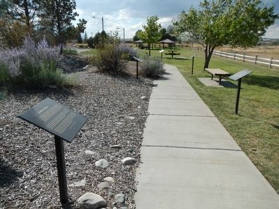
More about this marker. This marker is part of the Wyoming history walk in Centennial Park, which is adjacent to the Fort Caspar Museum and shares the parking lot.
Also see . . . The Bridger Trail: A Safer Route to Montana Gold -- WyoHistory
. ...mountain man Jim Bridger blazed a trail that was safer than the better-known Bozeman Trail, which ran through Sioux country east of the Bighorn Mountains in the Powder River Basin. Bridger's trail, west of the Bighorns, was much shorter than following the Oregon Trail and Lander Cutoff before turning north toward Montana, and shorter still than longer routes by way of Fort Bridger or Salt Lake City.
Even so, Bridger’s Trail never drew much traffic. Only five wagon trains took the new route: north through the Bighorn Basin to the Yellowstone Valley, west and over a divide into the Gallatin and Madison valleys and finally back south up the Madison to the gold fields near present Virginia City, Mont. (Submitted on December 25, 2015, by Barry Swackhamer of Brentwood, California.)
Credits. This page was last revised on January 12, 2021. It was originally submitted on December 25, 2015, by Barry Swackhamer of Brentwood, California. This page has been viewed 508 times since then and 26 times this year. Last updated on January 12, 2021, by Craig Baker of Sylmar, California. Photos: 1, 2. submitted on December 25, 2015, by Barry Swackhamer of Brentwood, California.

