Near Lindale in Smith County, Texas — The American South (West South Central)
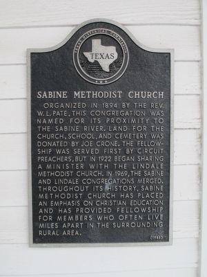
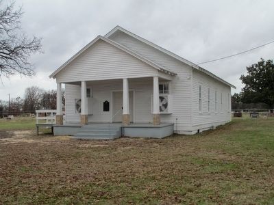
Sabine Methodist Church
Erected 1985 by Texas Historical Commission. (Marker Number 7753.)
Topics. This historical marker is listed in these topic lists: Cemeteries & Burial Sites • Churches & Religion. A significant historical year for this entry is 1894.
Location. 32° 33.806′ N, 95° 23.422′ W. Marker is near Lindale, Texas, in Smith County. Marker is at the intersection of County Road 4122 and Old Dallas-Shreveport Road (County Road 452), on the left when traveling north on County Road 4122. The marker is on the front wall of the Church. Touch for map. Marker is at or near this postal address: 13592 County Rd 4122, Lindale TX 75771, United States of America. Touch for directions.
Other nearby markers. At least 8 other markers are within 6 miles of this marker, measured as the crow flies. Bethesda Presbyterian Church and Cemetery (approx. 2.1 miles away); Whisenhunt-Kinzie House (approx. 3.6 miles away); Damascus Baptist Church (approx. 3.9 miles away); Duck Creek Soil Erosion Project (approx. 4 miles away); Site of Flora (approx. 4.2 miles away); Vial-Fragosa Trail (approx. 5˝ miles away); Hubbard Family Cemetery (approx. 5.9 miles away); Flewellen-Thweatt Cemetery (approx. 5.9 miles away). Touch for a list and map of all markers in Lindale.
More about this marker. The Church is located on the old Dallas Shreveport Road, which at this location was laid out by Smith County in 1851. Until the railroads reached Dallas in the late 1860's this was the main transportation route between Dallas and Shreveport.
Credits. This page was last revised on June 16, 2016. It was originally submitted on December 26, 2015, by Randal B. Gilbert of Tyler, Texas. This page has been viewed 510 times since then and 36 times this year. Photos: 1, 2. submitted on December 26, 2015, by Randal B. Gilbert of Tyler, Texas. • Andrew Ruppenstein was the editor who published this page.

