Troup in Smith County, Texas — The American South (West South Central)
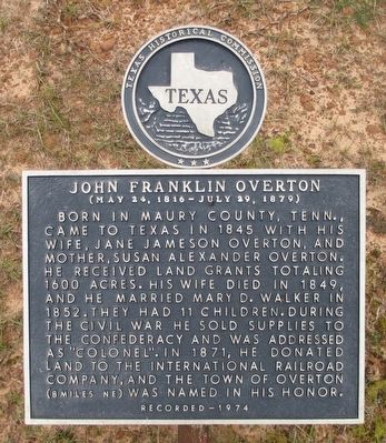
John Franklin Overton
(May 24, 1816 - July 29, 1879)
Erected 1974 by Texas Historical Commission. (Marker Number 7748.)
Topics. This historical marker is listed in these topic lists: Cemeteries & Burial Sites • Settlements & Settlers. A significant historical year for this entry is 1845.
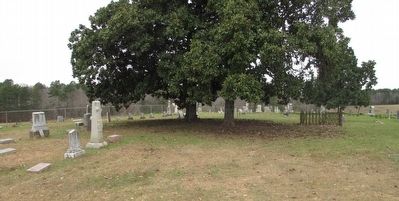
Location. 32° 13.15′ N, 95° 5.781′ W. Marker is in Troup, Texas, in Smith County. Marker can be reached from Farm to Market Road 345, half a mile east of County Route 230. The marker is located in the Elkins Cemetery, which is ¼ mile north of FM 345. Touch for map. Marker is in this post office area: Troup TX 75789, United States of America. Touch for directions.
Other nearby markers. At least 8 other markers are within 12 miles of this marker, measured as the crow flies. Omen (Canton) Community (approx. 0.6 miles away); First Baptist Church of Whitehouse (approx. 6.9 miles away); London Baptist Church (approx. 9.1 miles away); New London School Explosion (approx. 9.1 miles away); James Calhoun Hill (approx. 9.3 miles away); The Joiner No. 3 Daisy Bradford (approx. 10½ miles away); The First Well in the East Texas Oil Field (approx. 10.6 miles away); Headache Springs, C.S.A. (approx. 11.9 miles away).
Credits. This page was last revised on June 16, 2016. It was originally submitted on January 4, 2016, by Randal B. Gilbert of Tyler, Texas. This page has been viewed 508 times since then and 19 times this year. Photos: 1, 2. submitted on January 4, 2016, by Randal B. Gilbert of Tyler, Texas. • Bernard Fisher was the editor who published this page.
Editor’s want-list for this marker. A photo of the marker and the surrounding area in context. • Can you help?

