Marysville in Union County, Ohio — The American Midwest (Great Lakes)
Virginia Military District
Inscription.
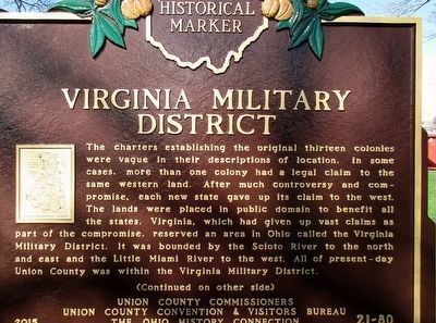
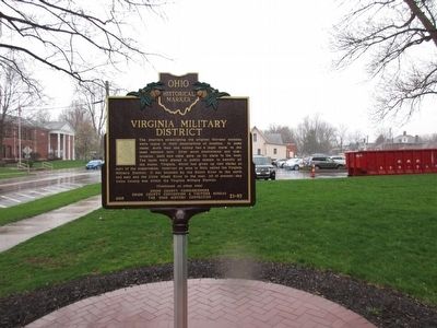
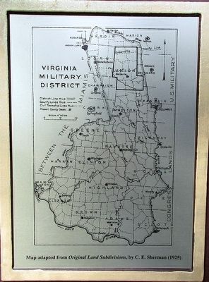
The charters establishing the original thirteen colonies were vague in their descriptions of location. In some cases, more than one colony had a legal claim to the same western land. After much controversy and compromise, each new state gave up its claim to the west. The lands were placed in public domain to benefit all the states. Virginia, which had given up vast claims as part of compromise, reserved an area in Ohio called the Virginia Military District. It was bounded by the Scioto River to the north and east and the Little Miami River to the west. All of present-day Union County was within the Virginia Military District.
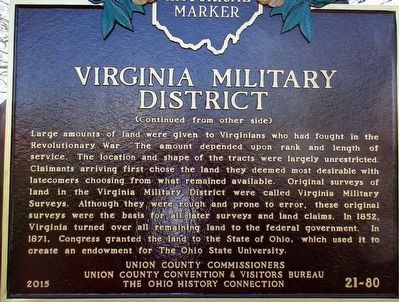
Large amounts of land were given to Virginians who had fought in the Revolutionary War. The amount depended upon rank and length of service. The locations and shape of the tracts were largely unrestricted. Claimants arriving first chose the land they deemed most desirable with latecomers choosing from what remained available. Original surveys of land in the Virginia Military District were called Virginia Military Surveys. Although they were rough and prone to error, these original surveys were the basis for all later surveys and land claims. In 1852, Virginia turned over all remaining land to the federal government. In 1871, Congress granted the land to the State of Ohio, which used it to create an endowment for The Ohio State University.
Erected 2015 by Union County Commissioners, Union County Convention and Visitors Bureau, The Ohio Historical Society. (Marker Number 21-80.)
Topics and series. This historical marker is listed in these topic lists: Government & Politics • Settlements & Settlers. In addition, it is included in the Ohio Historical Society / The Ohio History Connection series list.
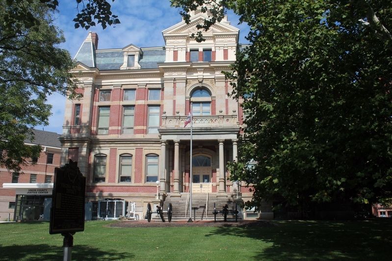
Location. 40° 14.133′ N, 83° 22.138′ W. Marker is in Marysville, Ohio, in Union County. Marker is on W 6th St, on the right when traveling west. marker is on the south lawn of the Union County Courthouse. Touch for map. Marker is at or near this postal address: 220 W 6th St, Marysville OH 43040, United States of America. Touch for directions.
Other nearby markers. At least 8 other markers are within walking distance of this marker. The Civil War Cannons (within shouting distance of this marker); The Oldest Brick House in Marysville (within shouting distance of this marker); The Spirit of '76 (about 300 feet away, measured in a direct line); Union County Veterans Monument (about 300 feet away); Union County, Ohio / Union County Courthouse (about 300 feet away); Cyprian Lee House / Colonel Noah Orr, “Union County Giant”
(about 300 feet away); Marysville, Ohio (about 500 feet away); Thomas O. Nuckles (about 500 feet away). Touch for a list and map of all markers in Marysville.
More about this marker. Text is somewhat simplistic concerning the background and boundaries of the VMD (often referred to as the VMS) There is no mention of the disputed, and unknown locations of the headwaters of the Scioto and Little Miami. There is no mention of Israel Ludlow, the frontier genius who surveyed the line from the Little Miami to the assumed headwaters of the Scioto. There is no mention of rectangular survey vs "metes and bounds".
Also see . . .
1. Virginia Military District. Wikipedia article (Submitted on November 6, 2019, by Joel Seewald of Madison Heights, Michigan.)
2. Virginia Military District. Information about the Virginia Military District on the Dublin (Ohio) Historical Society website. Includes the text of a land patent, example of a "metes and bounds" survey description, and the amount of land allotted to various military ranks. (Submitted on November 6, 2019, by Joel Seewald of Madison Heights, Michigan.)
Photographed By Rev. Ronald Irick, April 2, 2016
5. Virginia Military District Marker
C. E. Sherman's map of the VMS
I don't have a web-link, but this is the reference info for Sherman's work:
Original Ohio land subdivisions, by C. E. Sherman. 235 p., illustrated, 1925. Reprinted 1972, 1976, 1982, 1991, 2005.
Credits. This page was last revised on July 23, 2022. It was originally submitted on April 2, 2016, by Rev. Ronald Irick of West Liberty, Ohio. This page has been viewed 592 times since then and 60 times this year. Photos: 1, 2, 3. submitted on April 2, 2016, by Rev. Ronald Irick of West Liberty, Ohio. 4. submitted on October 4, 2020, by Robert Baughman of Bellefontaine, Ohio. 5. submitted on April 2, 2016, by Rev. Ronald Irick of West Liberty, Ohio. • Bill Pfingsten was the editor who published this page.
