South Rockwood in Wayne County, Michigan — The American Midwest (Great Lakes)
Hull's Trace
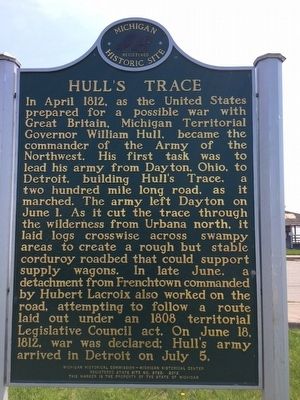
In April 1812, as the United States prepared for a possible war with Great Britain, Michigan Territorial Governor William Hull, became the commander of the Army of the Northwest. His first task was to lead his army from Dayton, Ohio, to Detroit, building Hull's Trace, a two hundred mile long road, as it marched. The army left Dayton on June 1. As it cut the trace through the wilderness from Urbana north, it laid logs crosswise across swampy areas to create a rough but stable corduroy roadbed that could support supply wagons. In late June, a detachment from Frenchtown commanded by Hubert Lacroix also worked on the road, attempting to follow a route laid out under an 1808 territorial Legislative Council act. On June 1812, war was declared; Hull's army arrived at Detroit on July 5th
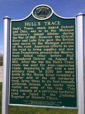
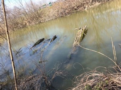
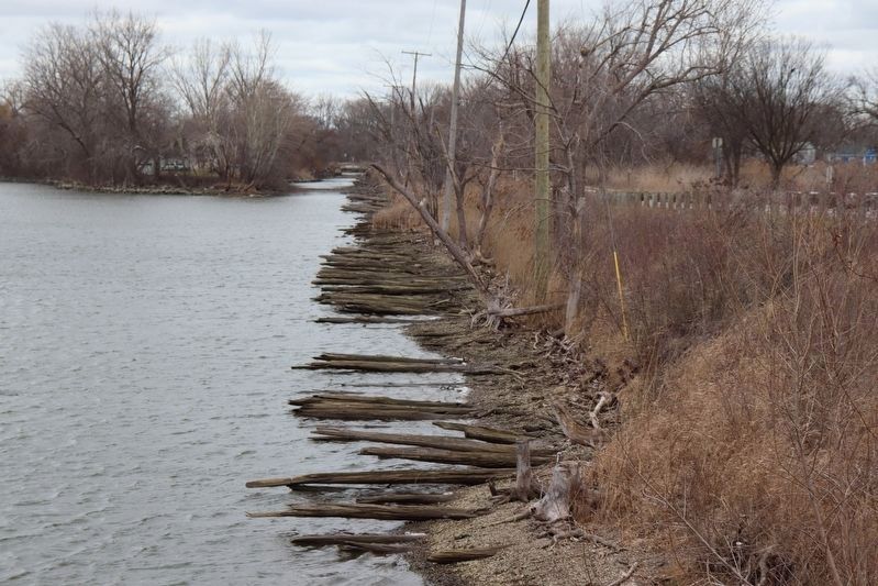
Hull's Trace, which linked Detroit and Ohio, was to be the Michigan Territory's inland lifeline during the war of 1812. However, the Detroit River and Lake Erie gave the British easy access to the Michigan portion of the road. American efforts to use the road to bring supplies and men from Frenchtown, present-day Monroe, were foiled twice before Hull surrendered Detroit on August 16, 1812. After the war the Hull's Trace route was used for ever-improving roads, beginning in 1817 with a new military road. In 2000 low water levels in the Huron River revealed a quarter mile of the old corduroy road, lying three to six feet under Jefferson Avenue. Axe marks were visible on some of the logs. This rare example of a surviving corduroy road is listed in the National Register of Historic Places.
Erected 2012 by Michigan Historical Commission, Michigan Historical Center. (Marker Number S725.)
Topics. This historical marker is listed in these topic lists: Roads & Vehicles • War of 1812. A significant historical year for this entry is 1812.
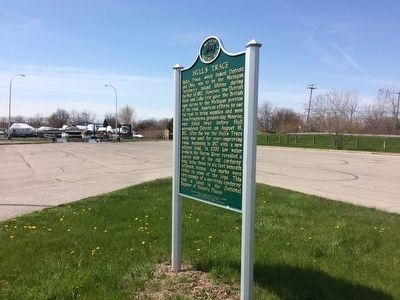
Location. 42° 2.597′ N, 83° 12.78′ W. Marker is in Rockwood, Michigan, in Wayne County. It is in South Rockwood. Marker is on West Jefferson Avenue, on the right when traveling north. The remnants of the road are across the road and slightly north of the marker. The logs are more or less visible depending on water levels. Touch for map. Marker is at or near this postal address: 36000 West Jefferson Avenue, Rockwood MI 48173, United States of America. Touch for directions.
Other nearby markers. At least 8 other markers are within 5 miles of this marker, measured as the crow flies. Pointe Mouillee Marsh (approx. ¾ mile away); Historic State Police Post (approx. 2½ miles away); State Police Post (approx. 2.6 miles away); War of 1812 Memorial (approx. 2.9 miles away); Battle of Brownstown (approx. 2.9 miles away); Old Hull Road (approx. 3.6 miles away); Anchor from the schooner "Oak Leaf" (approx. 3.6 miles away); Estral Beach Veterans Memorial (approx. 4.1 miles away). Touch for a list and map of all markers in Rockwood.
Additional commentary.
1. More info and photos can also be found on the Wikipedia entry.
https://en.wikipedia.org/wiki/Hull%27s_Trace_North_Huron_River_Corduroy_Segment
— Submitted April 21, 2016, by Michael Baker of Lima, Ohio.
Credits. This page was last revised on March 19, 2024. It was originally submitted on April 21, 2016, by Michael Baker of Lima, Ohio. This page has been viewed 647 times since then and 61 times this year. Last updated on December 21, 2022, by J.T. Lambrou of New Boston, Michigan. Photos: 1, 2, 3, 4. submitted on April 21, 2016, by Michael Baker of Lima, Ohio. 5. submitted on March 10, 2024, by Trevor L Whited of Kokomo, Indiana. • J. Makali Bruton was the editor who published this page.
