Near Newnan in Coweta County, Georgia — The American South (South Atlantic)
"The Big Raid"
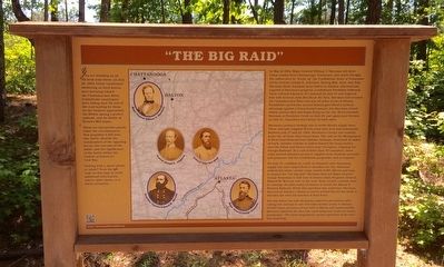
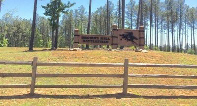
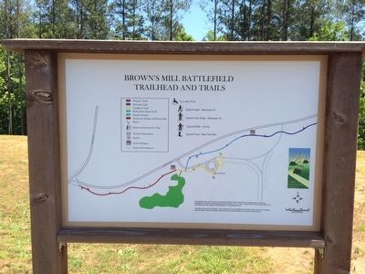
Brown's Mill Battlefield
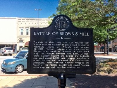
You are standing on an old farm road where, on July 30, 1864, Union cavalrymen sweltering on tired horses were hurrying toward the Chattahoochee River. Confederate cavalrymen were hiding near the end of the road waiting for them. As the Yankees approached, the Rebels sprang a perfect ambush, and the Battle of Brown's Mill began.
These six interpretive panels relate the circumstances that propelled 4,000 men into battle, identify the commanders of the opposing forces, the outcome of the battle, and the significance of the battle within the context of America's Civil War. Visiting with a smart phone or tablet? Scan the QR code on this sign to reach additional information videos, slide shows, or a battle animation.
In May of 1864, Major General William T. Sherman led three Union armies from Chattanooga, Tennessee, into north Georgia. His orders were to "break up" the Confederate Army of Tennessee led by General Joseph E. Johnston. During May, June, and July, Sherman drove Johnston from Dalton to Atlanta. Alarmed and angered at Sherman's progress, Confederate President Jefferson Davis relieved Johnston of command on July 17 and replaced him with General John Bell Hood. By then, Sherman had crossed the Chattahoochee River and was 10 miles north of Atlanta. Formidable earthworks around Atlanta gave Hood a tactical advantage against a Union frontal assault, but Sherman closed within cannon shot and began firing on the city. Hood attacked Sherman at Peachtree Creek on July 20, and again near Decatur on July 21. Casualties were heavy on both sides.
Sherman's primary strategy was to strike Hood's supply lines. Three railroads supplied Hood's army with food and armaments. Between July 17 and 24, 1864, Sherman's cavalry successfully broke two of these vital connections. The raid on the Montgomery & West Point Railroad near Opelika, Alabama, destroyed 26 miles of track. Another column of raiders burned two long trestles over the Yellow and Alcovy rivers near Covington, crippling the Georgia Railroad. At a cost of fewer than 70 casualties, these raids severed Atlanta's access to supplies from Alabama arsenals and granaries and the Confederate gunpowder mill at Augusta.
On July 25, confident he could cut Atlanta's only remaining supply line and compel Hood to abandon the city, Sherman ordered his entire cavalry corps, nearly 9,000 officers and men to prepare for "the big raid." Sherman directed Major General George Stoneman to ride east of Atlanta while Brigadier General Edward M. McCook rode to the west. Both cavalry columns were to converge 30 miles south of Atlanta to wreck the Macon & Western Railroad. While this operation was underway, Sherman directed an infantry
column to march around Hood's left flank to threaten the vital rail junction at East Point.
The day before the raid, Stoneman asked for permission after cutting the railroad to ride 100 miles farther south to liberate 30,000 Union prisoners of war held at Macon and Andersonville. Sherman admitted the idea was captivating and could not refuse permission. "The most stupendous cavalry operation of the war" was underway.
Erected 2013 by Coweta County, Georgia Departments of Transportation & Natural Resources.
Topics. This historical marker is listed in this topic list: War, US Civil. A significant historical month for this entry is May 1864.
Location. 33° 20.092′ N, 84° 50.347′ W. Marker is near Newnan, Georgia, in Coweta County. Marker can be reached from Millard Farmer Road, 0.4 miles east of Old Corinth Road, on the right when traveling east. Touch for map. Marker is at or near this postal address: 155 Millard Farmer Road, Newnan GA 30263, United States of America. Touch for directions.
Other nearby markers. At least 8 other markers are within 4 miles of this marker, measured as the crow flies. McCook's Raid (here, next to this marker); Wheeler's Pursuit (a few steps from this marker); The Battle of Brown's Mill: Detour to Battle (a few steps from this marker); The Battle of Brown's Mill: Ride for the River (a few steps from this marker); The Battle of Brown's Mill: Aftermath
(a few steps from this marker); Gen. Jos. Wheeler, C.S.A. (approx. 0.3 miles away); In Memoriam (approx. 0.3 miles away); William McIntosh (approx. 3˝ miles away). Touch for a list and map of all markers in Newnan.
Related markers. Click here for a list of markers that are related to this marker.
Credits. This page was last revised on May 30, 2020. It was originally submitted on May 16, 2016, by Mark Hilton of Montgomery, Alabama. This page has been viewed 758 times since then and 65 times this year. Photos: 1, 2, 3, 4, 5. submitted on May 16, 2016, by Mark Hilton of Montgomery, Alabama.


