Cheyenne in Laramie County, Wyoming — The American West (Mountains)
The Military 1867-1949
Fort David A. Russell - Fort Francis E. Warren
Inscription.
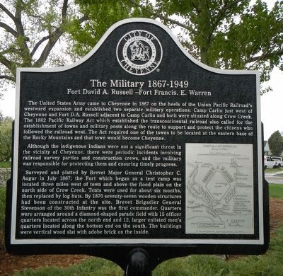
The United States Army came to Cheyenne in 1867 on the heels of the Union Pacific Railroad's westward expansion and established two separated military operations: Camp Carlin just west of Cheyenne and Fort D.A. Russell adjacent to Camp Carlin and both were situated along Crow Creek. The 1862 Pacific Railway Act which established the transcontinental railroad also called for the establishment of towns and military posts along the route to support and protect the citizens who followed the railroad west. The Act required one of the towns to be located at the at the eastern base of the Rocky Mountains and that town would become Cheyenne.
Although the indigenous Indians were not a significant threat in the vicinity of Cheyenne, there were periodic incidents involving railroad survey parties and construction crews, and the military was responsible for protecting them and ensuring timely progress.
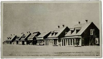
Surveyed and platted but Brevet Major General Christopher C. Augur in July 1867; the Fort which began as a tent camp was located three miles west of town and above the flood plain on the north side of Crow Creek. Tents were used for about six months, then replaced by log huts. By 1870 seventy-seven wooden structures had been constructed at the site. Brevet Brigadier General Stevenson of the 30th Infantry was the first commander. Quarters were arranged around a diamond-shaped parade field with 15 officer quarters located across the north end and 12, larger enlisted men's quarters located along the bottom end on the south. The buildings were vertical wood slat with adobe brick on the inside.
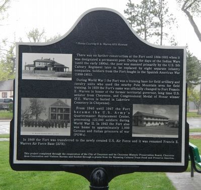
There was no further construction at the Fort until 1884-1885 when it was designated a permanent post. During the days of the Indian Wars (until the early 1890s), the post was manned primarily by the U.S. 5th Cavalry Regiment later to be replaced by eight separate infantry companies. Soldiers from the Fort fought in the Spanish American War (1898-1901).
During World War I the Fort was a training base for field artillery and cavalry units who used the nearby Pole Mountain area for field training. In 1929 the Fort's name was officially changed to Fort Francis E. Warren in honor of the former territorial governor, long time U.S. Senator from Cheyenne, and Congressional Medal of Honor winner (F.E. Warren is buried in Lakeview Cemetery in Cheyenne).
From 1940 until 1947 the Fort became the U.S. Army's Quartermaster Replacement Center, processing 122,000 soldiers during World War II. In 1943 the Fort also was home to approximately 1,000 German and Italian prisoners of war (POWs).
In 1949 the Fort was transferred to the newly created U.S. Air Force and was remained Francis E. Warren Air Force Base (AFB).
Erected by
City of Cheyenne, Cheyenne Historic Historic Preservation Board, Cheyenne Area Convention and Visitors Board, Wyoming Cultural Trust Fund and Preserve America.
Topics. This historical marker is listed in these topic lists: Forts and Castles • Wars, US Indian.
Location. 41° 8.722′ N, 104° 50.201′ W. Marker is in Cheyenne, Wyoming, in Laramie County. Marker is at the intersection of Randall Avenue and McComb Avenue, on the right when traveling east on Randall Avenue. Touch for map. Marker is at or near this postal address: 1399 Randall Ave, Cheyenne WY 82001, United States of America. Touch for directions.
Other nearby markers. At least 8 other markers are within walking distance of this marker. "Buffalo Soldiers" (here, next to this marker); The Military 1867-1890 (a few steps from this marker); The Military 1949-Present (within shouting distance of this marker); 1980 Capitol North National Historic District (approx. ¾ mile away); Early Cheyenne Reservoir (approx. 0.8 miles away); Camp Carlin (approx. 0.8 miles away); Cheyenne Frontier Days™ (Part I) (approx. 0.8 miles away); The Trails (Part III) (approx. 0.9 miles away). Touch for a list and map of all markers in Cheyenne.
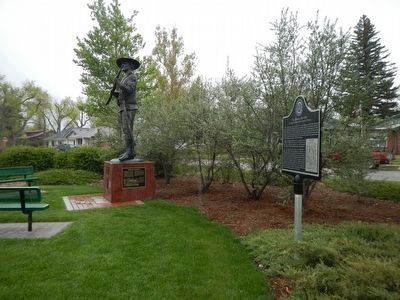
More about this marker. This marker is in a small triangular park bounded by Randall and McComb Avenues and West 32nd Street.
Also see . . .
Fort D.A. Russell - Wyoming Tales and Trails. The initial buildings were crudely constructed of board and batton.The barracks were insulated with adobe in the walls, but the area around the eaves were open from the shrinking of the lumber. Thus, one surgeon, in an 1870 report noted that the ventilation was "amply sufficient." The enlisted men's bunks were were equipped with mattresses filled with hay, two men per bunk. (Submitted on June 13, 2016, by Barry Swackhamer of Brentwood, California.)
Credits. This page was last revised on June 16, 2016. It was originally submitted on June 13, 2016, by Barry Swackhamer of Brentwood, California. This page has been viewed 507 times since then and 26 times this year. Photos: 1, 2, 3, 4. submitted on June 13, 2016, by Barry Swackhamer of Brentwood, California.


