Near Corydon in Harrison County, Indiana — The American Midwest (Great Lakes)
Battle of Corydon
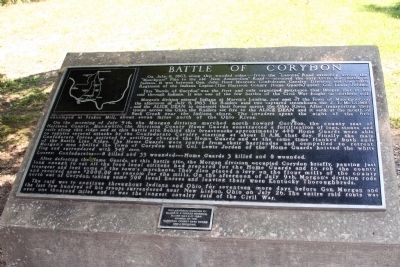
This “Battle of Corydon” was the first and only organized resistance that Morgan met in his raid through Indiana. It was one of the few battles of the Civil War fought on Northern soil.
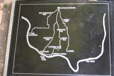
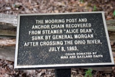
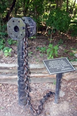
Morganís division entered Indiana at Morvinís Landing, just East of the Town of Mauckport, on the afternoon of July 8, 1863. The Raiders used two captured steamboats, the J. T. McCombs and the Alice Dean to transport their forces across the Ohio River. After transporting their troops across the Ohio, the Raiders set fire to the Alice Dean and it sank at the mouth of Buck Creek near the Indiana shore. The invaders spent the night of the 8th encamped at Frakes Mill, about seven miles North of the Ohio River.
On the morning of July 9th the Morgan division marched North toward Corydon, the county seat of Harrison County. Meanwhile, the Harrison County Home Guards constructed a fortification of logs, stones, and rails along this ridge and at this battle site. Behind this breastworks approximately 400 Home Guards were able to repulse several attacks by the Confederate Cavalry starting at about 11 A.M. that day. Finally the main Confederate forces assisted by artillery charged the Home Guards and at the same time flanked both ends of the Battle Line Ridge. The Home Guards were routed from their barricades and compelled to retreat. Morganís men shelled the Town of Corydon until Col. Lewis Jordan of the Home Guards hoisted the white flag and surrendered with 345 men.
Losses: Confederates - - - 8 killed and 33 wounded - - - Home Guards 3 killed and 8 wounded.
After defeating the Home Guards, at this battle site, the Morgan division occupied Corydon briefly, pausing just long enough to eat all the food local citizens had prepared for the Home Guards and to rob the county treasurer and loot some of the townís merchants. They also placed a levy on the flour mills of the county and received some $2,000.00 as ransom for the mills. On the afternoon of July 9th Morganís division rode North out of Corydon, taking some 500 local horses and leaving their worn Kentucky Thoroughbreds.
The raid was to continue throughout Indiana and Ohio for seventeen more days before Gen. Morgan and the last few hundred of his troops surrendered near New Lisbon, Ohio on July 26. The entire raid route was over one thousand miles and it was the longest cavalry raid of the Civil War.
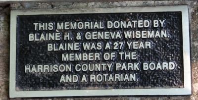
[[ Small Plaque ]]This memorial donated by Blaine H. & Geneva Wiseman. Blaine was a 27 year member of the Harrison County Park Board and a Rotarian.
Topics. This historical marker is listed in these topic lists: Education • War, US Civil. A significant historical date for this entry is July 9, 1863.
Location. 38° 11.993′ N, 86° 7.766′ W. Marker is near Corydon, Indiana, in Harrison County. Marker can be reached from Old Indiana 135 south of W. Heidelberg Rd. NW, on the right when traveling south. Located in Battle of Corydon Park which sits on Left after you pass W. Heidelberg Rd. NW.. Go into Park - - About half way into Park you will find Marker on the Left. Touch for map. Marker is in this post office area: Corydon IN 47112, United States of America. Touch for directions.
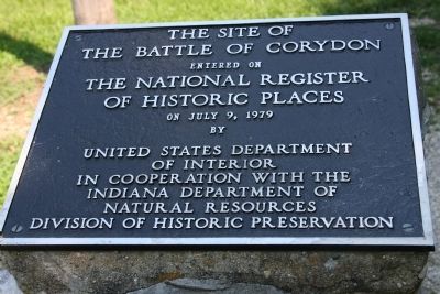
Other nearby markers. At least 8 other markers are within walking distance of this marker. Morgan's Confederate Dead (a few steps from this marker); Arville L. Funk (within shouting distance of this marker); The Site of The Battle of Corydon (within shouting distance of this marker); Mooring Post and Anchor Chain (within shouting distance of this marker); General John Morgan (within shouting distance of this marker); Site of the Battle of Corydon (within shouting distance of this marker); Harrison County (Indiana) Fair
(approx. half a mile away); A Fair to Remember (approx. half a mile away). Touch for a list and map of all markers in Corydon.
Related markers. Click here for a list of markers that are related to this marker. Virtual Tour by Markers of the Battle of Corydon
Also see . . . Route Morgan's Raiders took. from the Ohio River the troops took a rough and tumble route to the Battle of Corydon. (Submitted on August 1, 2008, by Al Wolf of Veedersburg, Indiana.)
Credits. This page was last revised on June 16, 2016. It was originally submitted on July 30, 2008, by Al Wolf of Veedersburg, Indiana. This page has been viewed 3,245 times since then and 94 times this year. Photos: 1, 2, 3, 4, 5, 6, 7. submitted on July 30, 2008, by Al Wolf of Veedersburg, Indiana. • Craig Swain was the editor who published this page.
