Root in Montgomery County, New York — The American Northeast (Mid-Atlantic)
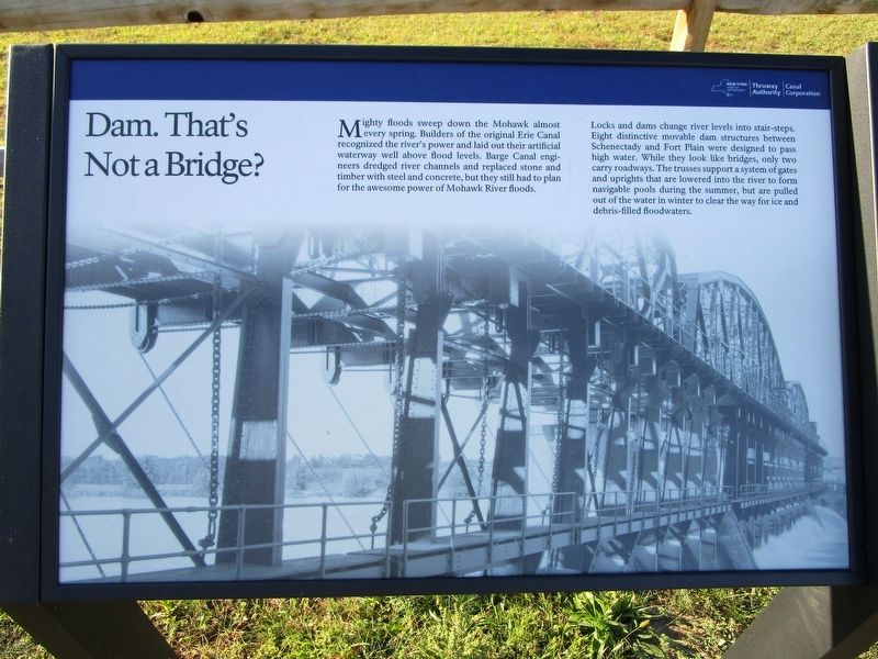
Dam. That's Not a Bridge?
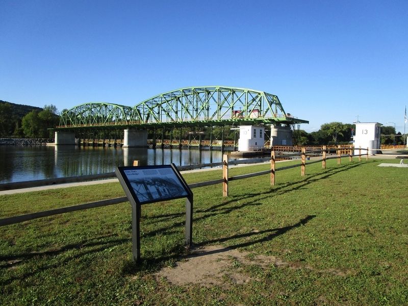
Locks and dams change river levels into stair-steps. Eight distinctive moveable dam structures between Schenectady and Fort Plain were designed to pass high water. While they look like bridges, only two carry roadways. The trusses support a system of gates and uprights that are lowered into the river to form navigable pools during the summer, but are pulled out of the water in winter to clear the way for ice and debris-filled floodwaters.
Erected 2016 by New York Thruway Authority / Canal Corporation.
Topics and series. This historical marker is listed in this topic list: Waterways & Vessels. In addition, it is included in the Erie Canal series list.
Location. 42° 55.026′ N, 74° 26.794′ W. Marker is in Root, New York, in Montgomery County. Marker can be reached from the intersection of Interstate 90 at milepost 187 and Lock 13 Living History Rest Area. Marker is at a new rest area for I-90 westbound travelers between exit 28 (Fultonville) and exit 29 (Canajoharie). The rest area is at Lock 13 on the Erie Barge Canal. It officially opened on August 11, 2016 at 11:30 am. Touch for map. Marker is in this post office area: Fultonville NY 12072, United States of America. Touch for directions.
Other nearby markers. At least 8 other markers are within walking distance of this marker. The Erie Canal (a few steps from this marker); a different marker also named The Erie Canal (within shouting distance of this marker); The Mohawk Valley (within shouting distance of this marker); a different marker also named The Erie Canal (within shouting distance of this marker); a different marker also named The Erie Canal (within shouting distance of this marker); Transportation is King / Modernization (within shouting distance of this marker); a different marker also named The Mohawk Valley (within shouting distance of this marker); a different marker also named The Mohawk Valley (within shouting distance of this marker).
Credits. This page was last revised on September 9, 2016. It was originally submitted on September 8, 2016, by Anton Schwarzmueller of Wilson, New York. This page has been viewed 324 times since then and 23 times this year. Photos: 1, 2. submitted on September 8, 2016, by Anton Schwarzmueller of Wilson, New York.

