Two Ways West from Westport
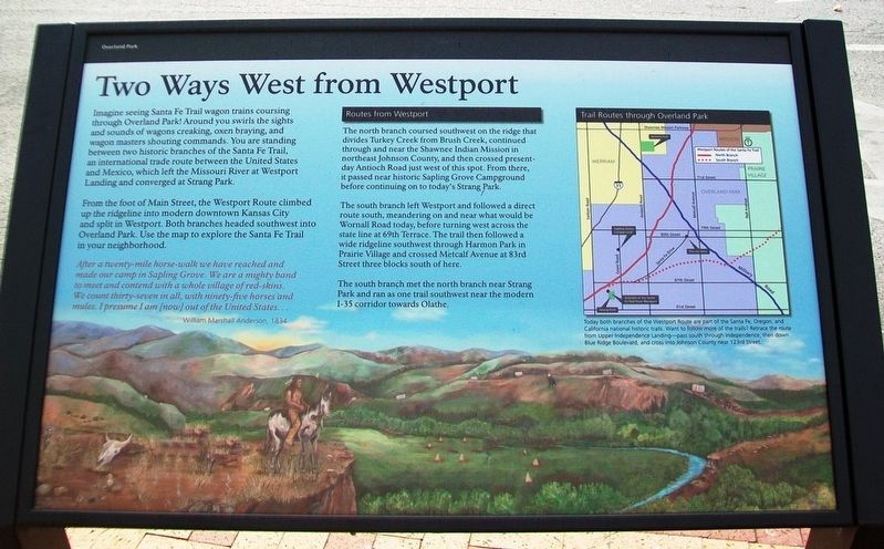
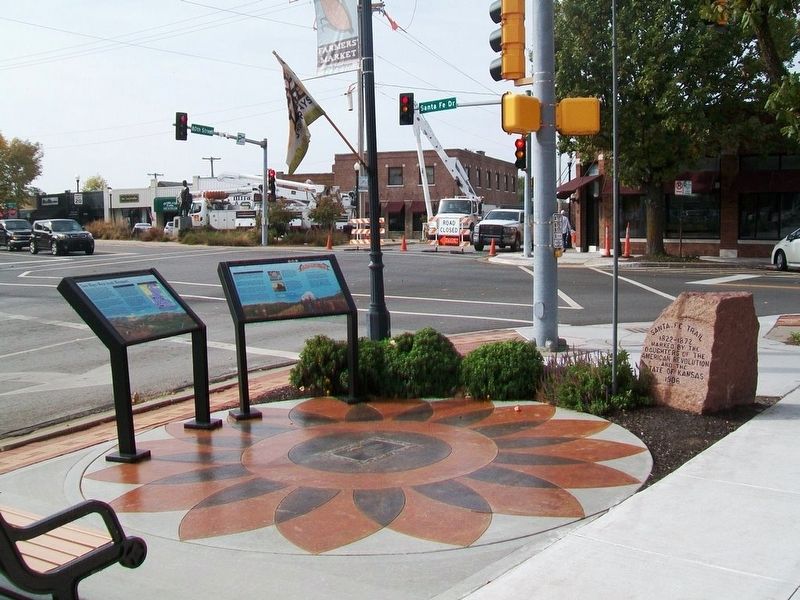
Imagine seeing Santa Fe Trail wagon trains coursing through Overland Park! Around you swirls the sights and sounds of wagons creaking, oxen braying, and wagon masters shouting commands. You are standing between two historic branches of the Santa Fe Trail, an international trade route between the United States and Mexico, which left the Missouri River at Westport Landing and converged at Strang Park.
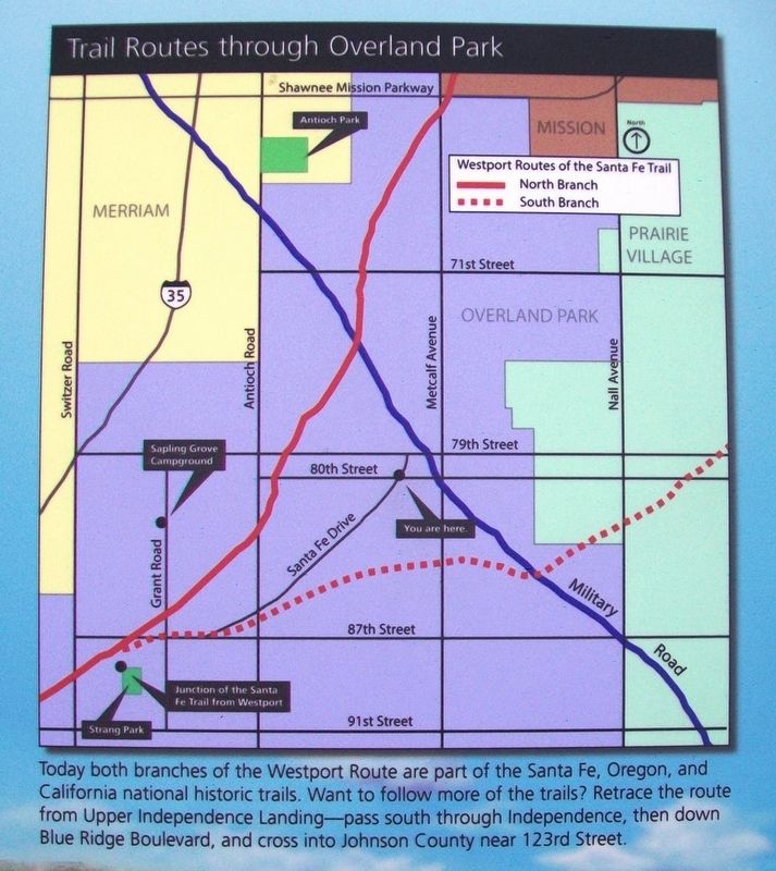
From the foot of Main Street, the Westport Route climbed up the ridgeline into modern downtown Kansas City and split in Westport. Both branches headed southwest into Overland Park. Use the map to explore the Santa Fe Trail in your neighborhood.
Routes from Westport
The north branch coursed southwest on the ridge that divides Turkey Creek from Brush Creek, continued through and near the Shawnee Indian Mission in northeast Johnson County, and then crossed present-day Antioch Road just west of this spot. From there, it passed near historic Sapling Grove Campground before continuing on to today's Strang Park.
The south branch left Westport and followed a direct route south, meandering on and near what would be Wornall Road today, before turning wwest across the state line at 69th Terrace. The trail then followed a wide ridgeline southwest through Harmon Park in Prairie Village and crossed Metcalf Avenue at 83rd Street
three blocks south of here.The south branch met the north branch near Strang Park and ran as one trail southwest near the modern I-35 corridor towards Olathe.
After a twenty-mile horse-walk we have reached and made our camp in Sapling Grove. We are a mighty band to meet and contend with a whole village of red-skins. We count thirty-seven in all, with ninety-five horses and mules. I presume I am [now] out of the United States...
William Marshall Anderson, 1834
[Map caption reads]
Today both branches of the Westport Route are part of the Santa Fe, Oregon, and California national historic trails. Want to follow more of the trails? Retrace the route from Upper Independence Landing—pass south through Independence, then down Blue Ridge Boulevard, and cross into Johnson County near 123rd Street.
Erected by National Park Service, City of Overland Park, and the Kansas City Area Historic Trails Association.
Topics and series. This historical marker is listed in these topic lists: Exploration • Industry & Commerce • Roads & Vehicles • Settlements & Settlers. In addition, it is included in the California Trail, the Oregon Trail, and the Santa Fe Trail series lists. A significant historical year for this entry is 1834.
Location. 38° 59.046′
Other nearby markers. At least 8 other markers are within walking distance of this marker. "A Day on the Trail" (here, next to this marker); A Day on the Santa Fe Trail (here, next to this marker); Santa Fe Trail (here, next to this marker); Voights Building (within shouting distance of this marker); Conser Garage & Bus Station (within shouting distance of this marker); William B. Strang, Jr. (within shouting distance of this marker); Overland Park State Bank Building (within shouting distance of this marker); Conser Store & Hall (within shouting distance of this marker). Touch for a list and map of all markers in Overland Park.
Also see . . .
1. Santa Fe National Historic Trail. (Submitted on November 1, 2016, by William Fischer, Jr. of Scranton, Pennsylvania.)
2. Oregon National Historic Trail. (Submitted on November 1, 2016, by William Fischer, Jr. of Scranton, Pennsylvania.)
3. California National Historic Trail. (Submitted on November 1, 2016, by William Fischer, Jr. of Scranton, Pennsylvania.)
Credits. This page was last revised on November 1, 2016. It was originally submitted on November 1, 2016, by William Fischer, Jr. of Scranton, Pennsylvania. This page has been viewed 526 times since then and 50 times this year. Photos: 1, 2, 3. submitted on November 1, 2016, by William Fischer, Jr. of Scranton, Pennsylvania.


