On Grenville Street (Nova Scotia Route 4) at Pepperell Street, on the right when traveling east on Grenville Street.
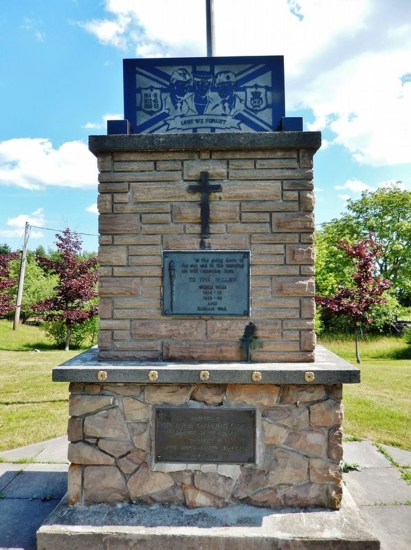
“at the going down of the sun and in the morning we will remember them.” To The Fallen World Wars 1914-18 1939-45 and Korean War — — Map (db m151583) WM
On Toulouse Street, on the right when traveling north.
English
St. Peter’s is one of Nova Scotia’s oldest settlements. The Portuguese were likely here in the 1500s, calling it San Pedro.
In 1650, the French established a post nearby under the name of Saint-Pierre, where they traded with the . . . — — Map (db m78728) HM
On Toulouse Street, on the right when traveling north.
English
The community of St. Peter’s is situated on the neck of land that separates the Bras d’Or Lake from the Atlantic Ocean. Up until the introduction of road and rail travel, the lake was the highway of the interior of Cape Breton and . . . — — Map (db m78729) HM
On Toulouse Street, on the left when traveling south.
There are two plaques on this monument
St. Peter’s Canal / Le Canal Saint-Pierre
English
Connecting St. Peter’s Bay on the Atlantic Ocean with the Bras d’Or Lakes, St. Peter’s Canal follows substantially the portage of the . . . — — Map (db m78726) HM
On Toulouse Street, on the right when traveling east.
English
Nicolas Denys, a merchant from Tours, France, arrived here in 1650 to restore an abandoned Portuguese fort called San Pedro. He renamed it Saint-Pierre, and set out to pursue fishing and trading - primarily in furs. Fort . . . — — Map (db m78727) HM
On Grenville Street (Nova Scotia Route 4) west of Pepperell Street, on the right when traveling west.
English: St. Peter's native son Wallace MacAskill (1887-1956) built an international reputation for his magical marine photography, but his fascination with the sea — and the ships and people who sailed on it — went far . . . — — Map (db m151582) HM