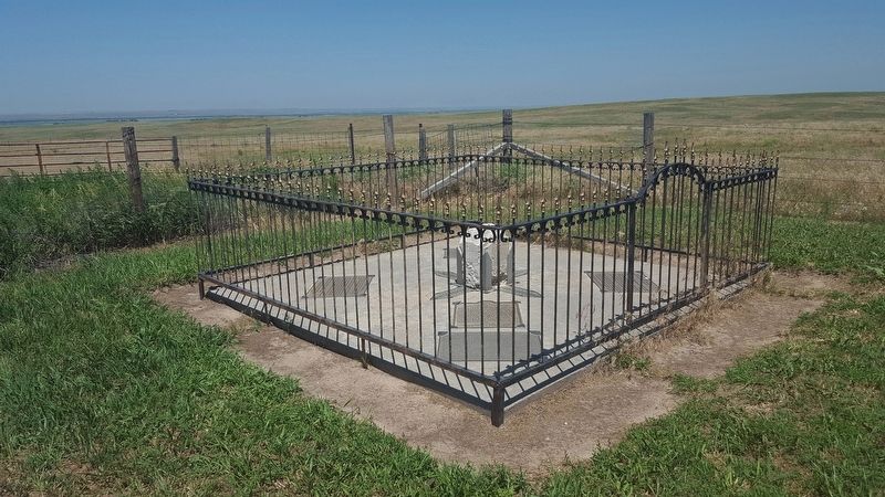
Organized May 3, 1873, when Perkins was still a part of Keith County. The southwest corner is the southwest corner section eighteen of township twelve, north, range forty-one of the 6th P.M.
Both the north and south Platte Rivers traverse . . . — — Map (db m119439) HM
The Organic Act creating the Territory of Colorado was signed by President Buchanan on February 26, 1861. The act carved from the territories of Kansas, Nebraska, Utah and New Mexico the 104,247 square miles that became the 38th state in 1876. . . . — — Map (db m119436) HM
The Northeastern most county in Colorado was first Weld County, later Logan County and established in its own right April 9, 1889.
It consists of 554 square miles, incorporating 3 towns: The County Seat, Julesburg, Ovid and Sedgwick.
. . . — — Map (db m119437) HM
The southeast corner of the Nebraska panhandle was organized November 6, 1888 from a part of Cheyenne County. Deuel County has two incorporated towns, Chappell, the County Seat and Big Springs.
Before 1850 Teton Sioux Indians camped on the . . . — — Map (db m119438) HM
Organized on November 8, 1887 from a part of Keith County. Consists of generally prairie land with some sand hills. Its northwest corner is the northwest corner of section nineteen, township twelve, north, range forty-one west of the 6th P.M, . . . — — Map (db m119440) HM
The large hill to the north, which became known as “California Hill,” was climbed by thousands of covered wagon emigrants heading west between 1841 and 1860. Many were bound for Oregon. California became the destination of the majority of travelers . . . — — Map (db m51229) HM
A relay station on the Pony Express Route, 1860-61, often referred to as Gill’s Station located near here at the crossing of the Oregon and Texas Trails. Pony Express stations in Keith County were Alkali, Sand Hill and Diamond Springs.
. . . — — Map (db m122909) HM
Federal Works Agency Public Works Administration John M. Carmody Federal Works Administrator Franklin D. Roosevelt President of the United States — — Map (db m311099) HM
Kingsley Dam and Lake McConaughy Kingsley Dam was constructed between 1936 and 1941 to form Lake McConaughy, Nebraska's largest lake and the main storage reservoir for the Central Nebraska Public Power and Irrigation District's hydro-irrigation . . . — — Map (db m311094) HM
[The Boot Hill Kiosk contains 5 panels each dealing with an aspect of the history of Boot Hill.]
[Panel 1]
Boot Hill Chronicles
1803 – The United States buys land from France known as the Louisiana Purchase including the . . . — — Map (db m51394) HM
One of the earliest cowboys of the many who rode the long trail north from Texas to Ogallala behind a herd of longhorns. Sanders first arrived here about 1869. He rode for William Paxton during the turbulent open range period of Western Nebraska. He . . . — — Map (db m51225) HM
For generations Nebraska’s Platte Valley provided a natural east-west travel route for native peoples, fur traders, explorers, emigrants, and the military. The first known passage by white men along the Great Platte River Road in the Keith County . . . — — Map (db m50782) HM
The Lincoln Highway was proclaimed the nation’s first coast-to-coast highway in 1913. It connected New York City with San Francisco, crossing twelve states and spanning 2,300 miles. The Lincoln Highway was created by an association of automobile . . . — — Map (db m50799) HM
Thin black lines indicate changes in relevance. Between each pair of lines entries are ordered geographically but all have the same relevance.
* Inflectional forms of words are their plurals, singulars, and possessives as well as gramatical tenses and similar variations.