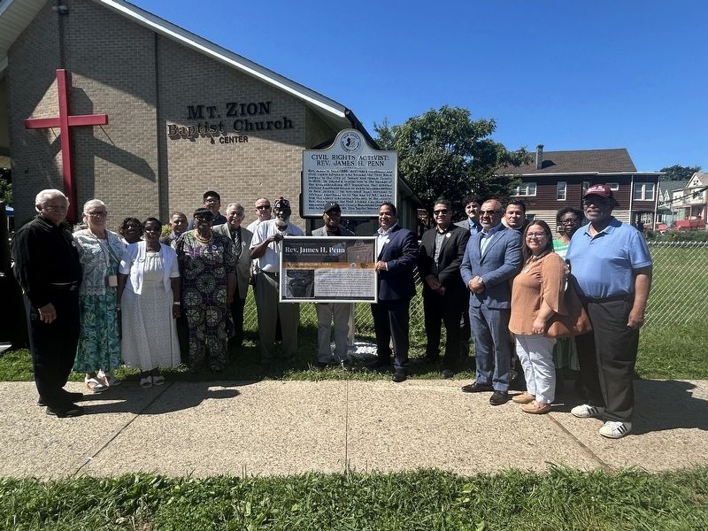
Rev. James H. Penn (1880-1977) was a trailblazer and civil rights advocate who became the first Black lawyer in the City of Passaic and Passaic County in 1909. He played a crucial role in the passage of the groundbreaking 1917 legislation that . . . — — Map (db m310575) HM
Built in 1904 on the former Roswell L. Colt estate, the Passaic County Court House was designed by New York Architect, Samuel Burrage Reed in the late Italian Renaissance Revival Style. The project was awarded through a public competition which was . . . — — Map (db m136722) HM
These two tombstones stood at the heads of the graves about 75 feet northwest of this spot. The bolt and shaft bearing were taken from the old gristmill at John Halmagh Post’s birthplace, Sloughter Dam, now 472 River Road, Garfield, New Jersey. . . . — — Map (db m36152) HM
Since Pompton was on the main route North, the Continental army camped here often. Washington quartered at the Schuyler House, July 12, 1777, and visited Colonel Van Cortlandt here, March 28, 1782. — — Map (db m166032) HM
Here, during the Revolution, were made cannon and shot for the Continental Army. Washington and Greene were quartered at the Manor home of Robert Erskine, Geographer of the Army. Here began the march of 3,000 soldiers to Yorktown. — — Map (db m40528) HM
October 9 – November 27, 1780, the patriot army extended along this site which had also been used in July. Washington came from his headquarters in Preakness to Totowa and visited the Van Houtens. — — Map (db m39730) HM
The Mansion of Colonel Theunis Dey The Headquarters of General Washington July ~ Oct ~ Nov ~ 1780 Acquired and restored 1930-1934 by The Passaic County Park Commission Marked by Capt. Abraham Godwin Chapter New Jersey Society S.A.R. . . . — — Map (db m39733) HM
(side facing north) On February 24, 1806, Businessman Israel Crane obtained a charter from the State of New Jersey to build a private toll road running from Broadway in Newark to Paterson-Hamburg Turnpike at Pompton in Morris County. He saw that . . . — — Map (db m104858) HM
Indian peoples inhabited this land from about 10,500 B.C. up to the early historic period. At the time of the European Settlement, they were referred to as the Munsee Delawares. In 1694 Arent Schuyler, on a fact finding mission to the Indians in . . . — — Map (db m62873) HM
Some 190 million years ago (Mesozoic Era), fluid lava as high as a ten story building rolled in a single flow from fifty miles away and solidified in this region. The basaltic ridge formed by these flows explains the basic geological formation of . . . — — Map (db m229372) HM
Founded in 1766 by Peter Hasenclever, the Long Pond Ironworks was run by a succession of famous ironmasters, including Robert Erskine, Martin J. Ryerson and Abraham S. Hewitt. The Long Pond furnace, forge and supporting village contributed to the . . . — — Map (db m23106) HM
In the 17th and early 18th centuries, while struggling to maintain their lifestyle of hunting, fishing and gathering, the Lenape released their lands to incoming Europeans through sales and treaties. The Europeans unwittingly brought with them . . . — — Map (db m233032) HM
Thin black lines indicate changes in relevance. Between each pair of lines entries are ordered geographically but all have the same relevance.
* Inflectional forms of words are their plurals, singulars, and possessives as well as gramatical tenses and similar variations.